
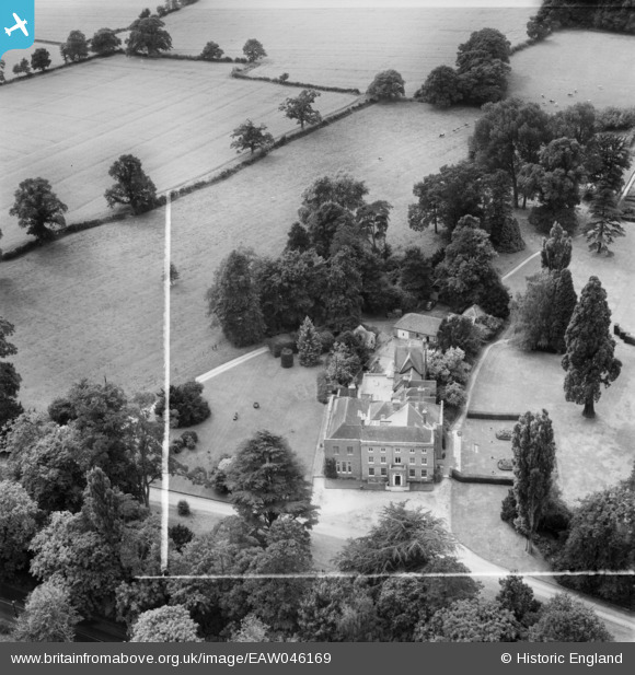
EAW046169 ENGLAND (1952). Sherfield Hall, Sherfield on Loddon, 1952. This image was marked by Aerofilms Ltd for photo editing.
© Copyright OpenStreetMap contributors and licensed by the OpenStreetMap Foundation. 2026. Cartography is licensed as CC BY-SA.
Nearby Images (9)
EAW046169

EAW046172

EAW046173

EAW046171

EAW046170

EAW046174

EAW046821

EAW046822

EAW046826

Details
| Title | [EAW046169] Sherfield Hall, Sherfield on Loddon, 1952. This image was marked by Aerofilms Ltd for photo editing. |
| Reference | EAW046169 |
| Date | 21-August-1952 |
| Link | |
| Place name | SHERFIELD ON LODDON |
| Parish | SHERFIELD ON LODDON |
| District | |
| Country | ENGLAND |
| Easting / Northing | 466755, 155984 |
| Longitude / Latitude | -1.0424025387771, 51.298556443268 |
| National Grid Reference | SU668560 |
Pins
Be the first to add a comment to this image!