
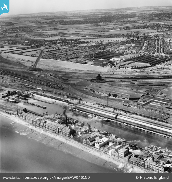
EAW046150 ENGLAND (1952). St Andrew's Dock Extension and environs, Kingston upon Hull, from the south-east, 1952
© Copyright OpenStreetMap contributors and licensed by the OpenStreetMap Foundation. 2026. Cartography is licensed as CC BY-SA.
Nearby Images (2)
EAW046150

EPW010809

Details
| Title | [EAW046150] St Andrew's Dock Extension and environs, Kingston upon Hull, from the south-east, 1952 |
| Reference | EAW046150 |
| Date | 22-August-1952 |
| Link | |
| Place name | KINGSTON UPON HULL |
| Parish | |
| District | |
| Country | ENGLAND |
| Easting / Northing | 507072, 426786 |
| Longitude / Latitude | -0.37695547398844, 53.726247336178 |
| National Grid Reference | TA071268 |
Pins
 |

CartoonHead |
Monday 29th of August 2016 10:00:40 PM |
|
CartoonHead |
Tuesday 23rd of June 2015 09:15:54 PM | |
|
CartoonHead |
Tuesday 23rd of June 2015 09:12:26 PM | |
|
John Wass |
Thursday 16th of October 2014 02:59:02 PM | |
|
John Wass |
Thursday 16th of October 2014 02:57:47 PM | |
|
John Wass |
Thursday 16th of October 2014 02:54:43 PM | |
|
John Wass |
Thursday 16th of October 2014 02:53:30 PM | |
|
John Wass |
Thursday 16th of October 2014 02:52:21 PM | |
|
John Wass |
Thursday 16th of October 2014 02:50:49 PM | |
|
John Wass |
Thursday 16th of October 2014 02:44:25 PM | |
|
John Wass |
Tuesday 2nd of September 2014 03:48:19 PM | |
|
John Wass |
Wednesday 20th of August 2014 11:39:37 AM |