
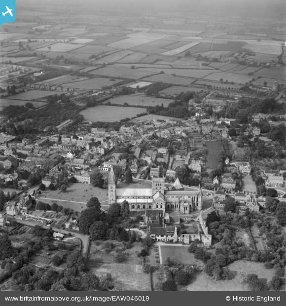
EAW046019 ENGLAND (1952). Southwell Minster and the town centre, Southwell, from the south, 1952
© Copyright OpenStreetMap contributors and licensed by the OpenStreetMap Foundation. 2026. Cartography is licensed as CC BY-SA.
Nearby Images (12)
EAW046019

EAW031250
, Southwell, 1950")
EAW031248
, Southwell, 1950")
EAW031252
, Southwell, 1950")
EAW031251
, Southwell, 1950")
EAW031254
, Southwell, 1950")
EAW031253
, Southwell, 1950")
EAW031249
, Southwell, 1950")
EAW046021

EAW046023

EAW046022

EAW046020

Details
| Title | [EAW046019] Southwell Minster and the town centre, Southwell, from the south, 1952 |
| Reference | EAW046019 |
| Date | 22-August-1952 |
| Link | |
| Place name | SOUTHWELL |
| Parish | SOUTHWELL |
| District | |
| Country | ENGLAND |
| Easting / Northing | 470144, 353765 |
| Longitude / Latitude | -0.95283498902224, 53.076202422359 |
| National Grid Reference | SK701538 |
Pins
Be the first to add a comment to this image!