
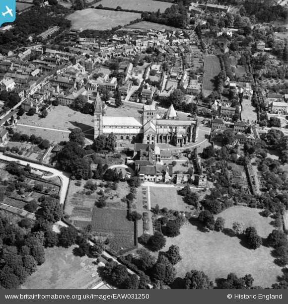
EAW031250 ENGLAND (1950). Southwell Minster (the Minster Church of St Mary the Virgin), Southwell, 1950
© Copyright OpenStreetMap contributors and licensed by the OpenStreetMap Foundation. 2026. Cartography is licensed as CC BY-SA.
Nearby Images (12)
EAW031250
, Southwell, 1950")
EAW046019

EAW031252
, Southwell, 1950")
EAW031251
, Southwell, 1950")
EAW031254
, Southwell, 1950")
EAW031253
, Southwell, 1950")
EAW031249
, Southwell, 1950")
EAW031248
, Southwell, 1950")
EAW046021

EAW046023

EAW046022

EAW046020

Details
| Title | [EAW031250] Southwell Minster (the Minster Church of St Mary the Virgin), Southwell, 1950 |
| Reference | EAW031250 |
| Date | 26-July-1950 |
| Link | |
| Place name | SOUTHWELL |
| Parish | SOUTHWELL |
| District | |
| Country | ENGLAND |
| Easting / Northing | 470157, 353769 |
| Longitude / Latitude | -0.95264007761521, 53.0762366691 |
| National Grid Reference | SK702538 |
Pins
Be the first to add a comment to this image!