
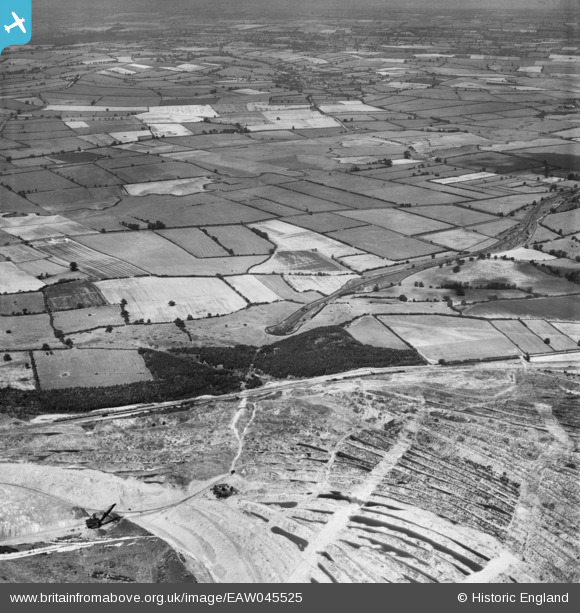
EAW045525 ENGLAND (1952). Quarrying alongside Gretton East Plantation and the surrounding countryside, Gretton, 1952
© Copyright OpenStreetMap contributors and licensed by the OpenStreetMap Foundation. 2025. Cartography is licensed as CC BY-SA.
Nearby Images (3)
EAW045525

EAW044681

EAW045524

Details
| Title | [EAW045525] Quarrying alongside Gretton East Plantation and the surrounding countryside, Gretton, 1952 |
| Reference | EAW045525 |
| Date | 6-August-1952 |
| Link | |
| Place name | GRETTON |
| Parish | GRETTON |
| District | |
| Country | ENGLAND |
| Easting / Northing | 488971, 292822 |
| Longitude / Latitude | -0.68843050741414, 52.525634007305 |
| National Grid Reference | SP890928 |
Pins
Be the first to add a comment to this image!