
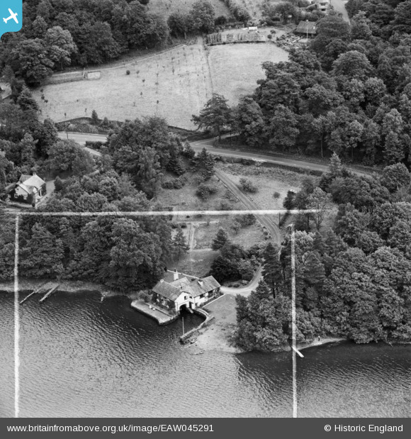
EAW045291 ENGLAND (1952). The Boat House, Ghyll Head, 1952. This image was marked by Aerofilms Ltd for photo editing.
© Copyright OpenStreetMap contributors and licensed by the OpenStreetMap Foundation. 2025. Cartography is licensed as CC BY-SA.
Nearby Images (8)
EAW045291

EAW045292

EAW045296

EAW045290

EAW045289

EAW045294

EAW045287

EAW045288

Details
| Title | [EAW045291] The Boat House, Ghyll Head, 1952. This image was marked by Aerofilms Ltd for photo editing. |
| Reference | EAW045291 |
| Date | 25-July-1952 |
| Link | |
| Place name | GHYLL HEAD |
| Parish | CARTMEL FELL |
| District | |
| Country | ENGLAND |
| Easting / Northing | 339179, 492856 |
| Longitude / Latitude | -2.9353225057568, 54.327494711094 |
| National Grid Reference | SD392929 |
Pins
Be the first to add a comment to this image!
User Comment Contributions
The most magical place where my very dear dear friends have lived for many years. |

Susie Ibbo |
Friday 11th of September 2015 10:52:44 AM |