
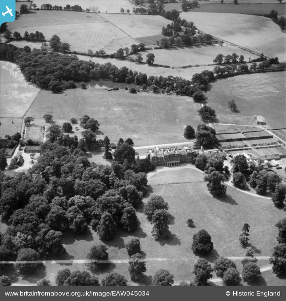
EAW045034 ENGLAND (1952). St Benedict's School, Wokefield Park, 1952. This image was marked by Aerofilms Ltd for photo editing.
© Copyright OpenStreetMap contributors and licensed by the OpenStreetMap Foundation. 2025. Cartography is licensed as CC BY-SA.
Nearby Images (8)
EAW045034

EAW045032

EAW045031

EAW045030

EAW045036

EAW045037

EAW045038

EAW045029

Details
| Title | [EAW045034] St Benedict's School, Wokefield Park, 1952. This image was marked by Aerofilms Ltd for photo editing. |
| Reference | EAW045034 |
| Date | 26-July-1952 |
| Link | |
| Place name | WOKEFIELD PARK |
| Parish | WOKEFIELD |
| District | |
| Country | ENGLAND |
| Easting / Northing | 467366, 165631 |
| Longitude / Latitude | -1.0318131467691, 51.385225137461 |
| National Grid Reference | SU674656 |
Pins
Be the first to add a comment to this image!