
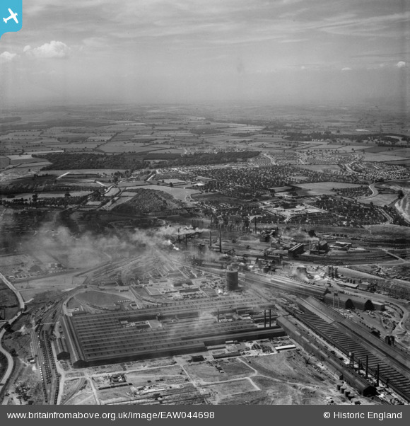
EAW044698 ENGLAND (1952). The Corby Steelworks and the town, Corby, from the east, 1952
© Copyright OpenStreetMap contributors and licensed by the OpenStreetMap Foundation. 2026. Cartography is licensed as CC BY-SA.
Nearby Images (15)
EAW044698

EPW049773

EAW045561

EPW049766

EPW049769

EAW034130

EAW034134

EAW034125

EAW034127

EAW034122

EAW034129

EAW034131

EAW034128

EAW045454
, Corby, from the south-east, 1952")
EAW045439

Details
| Title | [EAW044698] The Corby Steelworks and the town, Corby, from the east, 1952 |
| Reference | EAW044698 |
| Date | 22-July-1952 |
| Link | |
| Place name | CORBY |
| Parish | |
| District | |
| Country | ENGLAND |
| Easting / Northing | 490266, 289494 |
| Longitude / Latitude | -0.6702491093118, 52.49550711576 |
| National Grid Reference | SP903895 |
Pins
Be the first to add a comment to this image!