
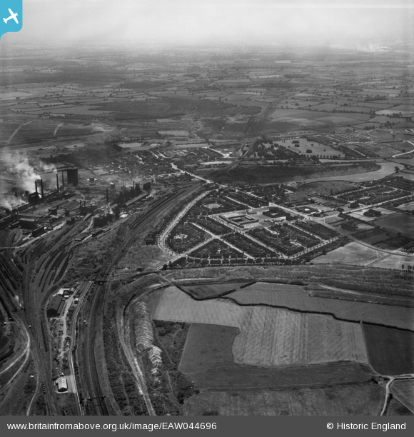
EAW044696 ENGLAND (1952). Stephenson Way and adjacent Corby Steelworks, Corby, from the north, 1952
© Copyright OpenStreetMap contributors and licensed by the OpenStreetMap Foundation. 2025. Cartography is licensed as CC BY-SA.
Nearby Images (2)
EAW044696

EAW045471

Details
| Title | [EAW044696] Stephenson Way and adjacent Corby Steelworks, Corby, from the north, 1952 |
| Reference | EAW044696 |
| Date | 22-July-1952 |
| Link | |
| Place name | CORBY |
| Parish | |
| District | |
| Country | ENGLAND |
| Easting / Northing | 489358, 290227 |
| Longitude / Latitude | -0.68342459992765, 52.502245300862 |
| National Grid Reference | SP894902 |
Pins

Dougie |
Tuesday 2nd of November 2021 09:05:25 PM | |
|
Dougie |
Friday 10th of April 2020 04:58:52 PM | |
|
Dougie |
Friday 10th of April 2020 04:57:08 PM | |
|
Michael Mahon |
Sunday 11th of October 2015 09:22:43 PM | |
|
Michael Mahon |
Sunday 11th of October 2015 09:21:40 PM | |
|
Michael Mahon |
Sunday 11th of October 2015 09:21:00 PM |