
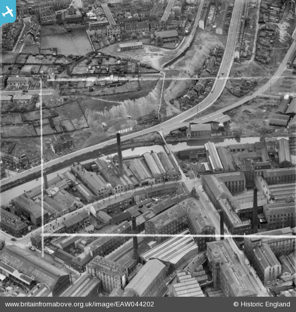
EAW044202 ENGLAND (1952). The Union Iron Works off Colne Road and the surrounding area, Huddersfield, 1952. This image was marked by Aerofilms Ltd for photo editing.
© Copyright OpenStreetMap contributors and licensed by the OpenStreetMap Foundation. 2026. Cartography is licensed as CC BY-SA.
Nearby Images (17)
EAW044202

EAW044203

EAW044208

EAW044204

EAW044207

EAW044209

EAW044205

EAW044201

EAW044206

EAW010403

EAW010404

EAW010402

EAW010406

EAW010401

EAW010407

EAW010405

EAW010400

Details
| Title | [EAW044202] The Union Iron Works off Colne Road and the surrounding area, Huddersfield, 1952. This image was marked by Aerofilms Ltd for photo editing. |
| Reference | EAW044202 |
| Date | 23-June-1952 |
| Link | |
| Place name | HUDDERSFIELD |
| Parish | |
| District | |
| Country | ENGLAND |
| Easting / Northing | 414508, 415798 |
| Longitude / Latitude | -1.7805478438323, 53.638264754821 |
| National Grid Reference | SE145158 |
