
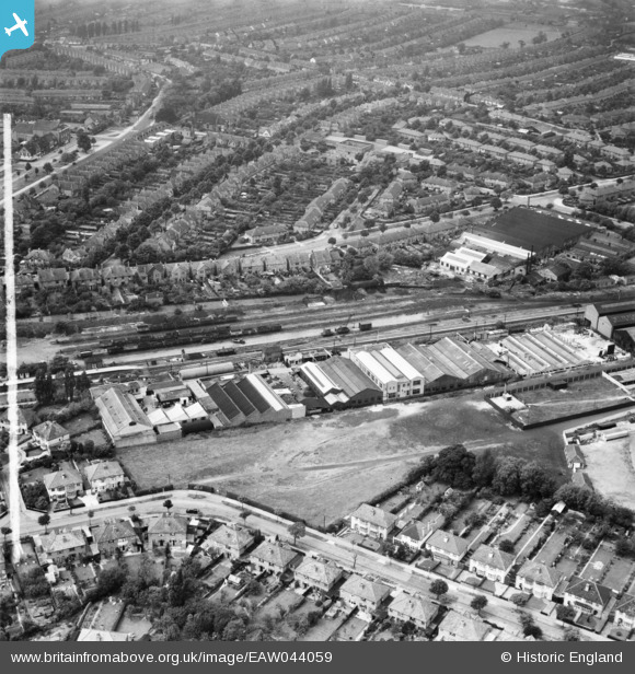
EAW044059 ENGLAND (1952). Industrial buildings next to the railway line and surrounding residential streets, Hall Green, 1952. This image was marked by Aerofilms Ltd for photo editing.
© Copyright OpenStreetMap contributors and licensed by the OpenStreetMap Foundation. 2026. Cartography is licensed as CC BY-SA.
Nearby Images (12)
EAW044059

EAW044056

EAW044060

EAW044052

EAW044053

EAW044061

EAW044055

EAW044057

EAW044054

EAW044058

EAW044062

EPW027017

Details
| Title | [EAW044059] Industrial buildings next to the railway line and surrounding residential streets, Hall Green, 1952. This image was marked by Aerofilms Ltd for photo editing. |
| Reference | EAW044059 |
| Date | 16-June-1952 |
| Link | |
| Place name | HALL GREEN |
| Parish | |
| District | |
| Country | ENGLAND |
| Easting / Northing | 410674, 282264 |
| Longitude / Latitude | -1.8429651239692, 52.43786954127 |
| National Grid Reference | SP107823 |
Pins

pat |
Friday 18th of April 2025 10:23:57 AM |
