
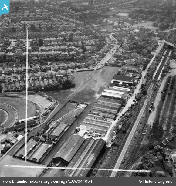
EAW044054 ENGLAND (1952). Industrial buildings next to the railway line, Hall Green, 1952. This image was marked by Aerofilms Ltd for photo editing.
© Copyright OpenStreetMap contributors and licensed by the OpenStreetMap Foundation. 2026. Cartography is licensed as CC BY-SA.
Nearby Images (12)
EAW044054

EAW044057

EAW044052

EAW044061

EAW044062

EAW044058

EAW044055

EAW044060

EAW044056

EAW044059

EPW027017

EAW044053

Details
| Title | [EAW044054] Industrial buildings next to the railway line, Hall Green, 1952. This image was marked by Aerofilms Ltd for photo editing. |
| Reference | EAW044054 |
| Date | 16-June-1952 |
| Link | |
| Place name | HALL GREEN |
| Parish | |
| District | |
| Country | ENGLAND |
| Easting / Northing | 410752, 282179 |
| Longitude / Latitude | -1.8418203367379, 52.437103773818 |
| National Grid Reference | SP108822 |
Pins

Ron41 |
Sunday 12th of October 2014 09:44:10 PM | |
|
PennyB |
Sunday 12th of October 2014 01:50:16 PM | |
|
PennyB |
Sunday 12th of October 2014 01:49:37 PM | |
|
PennyB |
Sunday 12th of October 2014 01:47:51 PM | |
|
PennyB |
Sunday 12th of October 2014 01:44:54 PM | |
|
PennyB |
Sunday 12th of October 2014 01:44:02 PM | |
|
PennyB |
Sunday 12th of October 2014 01:40:47 PM | |
|
PennyB |
Sunday 12th of October 2014 01:40:13 PM | |
|
PennyB |
Sunday 12th of October 2014 01:38:52 PM | |
|
PennyB |
Sunday 12th of October 2014 01:37:40 PM | |
|
PennyB |
Sunday 12th of October 2014 01:37:03 PM |