
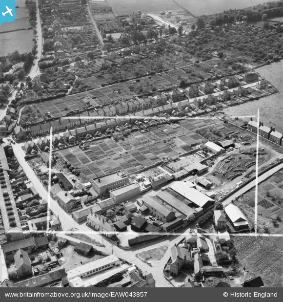
EAW043857 ENGLAND (1952). H.G. Twilley Ltd Buildings and adjacent Saw Mill on West Street, Stamford, 1952. This image was marked by Aerofilms Ltd for photo editing.
© Copyright OpenStreetMap contributors and licensed by the OpenStreetMap Foundation. 2026. Cartography is licensed as CC BY-SA.
Nearby Images (17)
EAW043857

EAW043852

EAW043856

EAW043854

EAW043851

EAW043855

EAW043858

EAW043853

EAW033040

EAW033038

EAW033039

EAW033036

EAW033034

EAW033035

EAW033032

EAW033037

EAW033031

Details
| Title | [EAW043857] H.G. Twilley Ltd Buildings and adjacent Saw Mill on West Street, Stamford, 1952. This image was marked by Aerofilms Ltd for photo editing. |
| Reference | EAW043857 |
| Date | 10-June-1952 |
| Link | |
| Place name | STAMFORD |
| Parish | STAMFORD |
| District | |
| Country | ENGLAND |
| Easting / Northing | 502392, 307014 |
| Longitude / Latitude | -0.48626467584795, 52.650830452892 |
| National Grid Reference | TF024070 |
Pins
Be the first to add a comment to this image!