
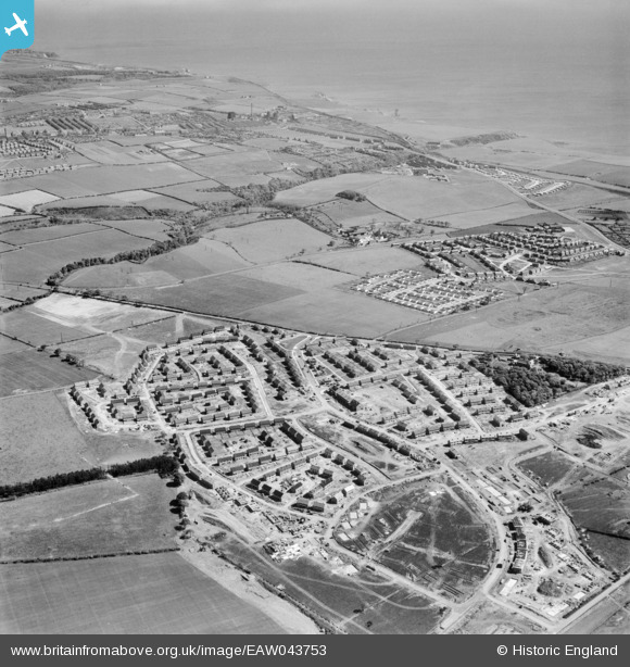
EAW043753 ENGLAND (1952). New houses at Peterlee and Horden, Peterlee, from the south-west, 1952
© Copyright OpenStreetMap contributors and licensed by the OpenStreetMap Foundation. 2026. Cartography is licensed as CC BY-SA.
Nearby Images (5)
EAW043753

EAW043750

EAW043752

EAW043749

EAW043751

Details
| Title | [EAW043753] New houses at Peterlee and Horden, Peterlee, from the south-west, 1952 |
| Reference | EAW043753 |
| Date | 5-June-1952 |
| Link | |
| Place name | PETERLEE |
| Parish | PETERLEE |
| District | |
| Country | ENGLAND |
| Easting / Northing | 442693, 541507 |
| Longitude / Latitude | -1.3363713228368, 54.7665743202 |
| National Grid Reference | NZ427415 |
Pins

Wayne23 |
Sunday 13th of October 2024 10:49:06 PM | |
|
Wayne23 |
Sunday 13th of October 2024 10:42:53 PM | |
|
Wayne23 |
Sunday 13th of October 2024 10:41:50 PM | |
|
Wayne23 |
Sunday 13th of October 2024 10:41:11 PM | |
|
Wayne23 |
Sunday 13th of October 2024 10:40:10 PM |