
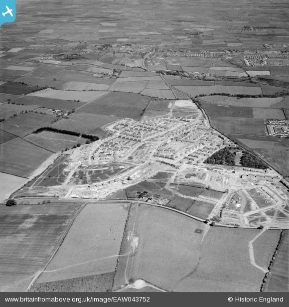
EAW043752 ENGLAND (1952). Yoden Road and new houses under construction, Peterlee, 1952
© Copyright OpenStreetMap contributors and licensed by the OpenStreetMap Foundation. 2026. Cartography is licensed as CC BY-SA.
Nearby Images (6)
EAW043752

EAW043750

EAW043753

EAW043749

EAW043751

EAW043757

Details
| Title | [EAW043752] Yoden Road and new houses under construction, Peterlee, 1952 |
| Reference | EAW043752 |
| Date | 5-June-1952 |
| Link | |
| Place name | PETERLEE |
| Parish | PETERLEE |
| District | |
| Country | ENGLAND |
| Easting / Northing | 442715, 541569 |
| Longitude / Latitude | -1.3360202536551, 54.767129640724 |
| National Grid Reference | NZ427416 |
Pins

Porcy |
Tuesday 11th of July 2017 04:21:00 PM | |
|
Porcy |
Tuesday 11th of July 2017 04:19:52 PM | |
|
Porcy |
Tuesday 11th of July 2017 04:02:26 PM | |
|
Porcy |
Tuesday 11th of July 2017 03:59:50 PM | |
|
Porcy |
Tuesday 11th of July 2017 03:57:35 PM | |
|
Porcy |
Tuesday 11th of July 2017 03:56:15 PM | |
|
Porcy |
Tuesday 11th of July 2017 03:49:23 PM | |
|
Porcy |
Tuesday 11th of July 2017 03:46:05 PM | |
|
Porcy |
Tuesday 11th of July 2017 03:44:50 PM | |
|
Porcy |
Tuesday 11th of July 2017 03:41:54 PM | |
|
Porcy |
Tuesday 11th of July 2017 03:37:00 PM |