
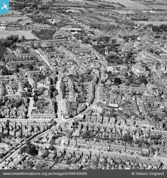
EAW043686 ENGLAND (1952). Maldon Road and the surrounding town, Colchester, 1952
© Copyright OpenStreetMap contributors and licensed by the OpenStreetMap Foundation. 2026. Cartography is licensed as CC BY-SA.
Nearby Images (5)
EAW043686

EPW001856

EAW014001

EPW001855

EAW037256

Details
| Title | [EAW043686] Maldon Road and the surrounding town, Colchester, 1952 |
| Reference | EAW043686 |
| Date | 4-June-1952 |
| Link | |
| Place name | COLCHESTER |
| Parish | |
| District | |
| Country | ENGLAND |
| Easting / Northing | 599118, 224863 |
| Longitude / Latitude | 0.89370179550184, 51.886268360731 |
| National Grid Reference | TL991249 |
Pins

woodsy007 |
Sunday 27th of July 2014 10:34:27 PM | |
|
woodsy007 |
Sunday 27th of July 2014 10:33:54 PM | |
|
woodsy007 |
Sunday 27th of July 2014 10:33:14 PM | |
|
woodsy007 |
Sunday 27th of July 2014 10:29:10 PM | |
|
woodsy007 |
Sunday 27th of July 2014 10:26:16 PM | |
|
woodsy007 |
Sunday 27th of July 2014 10:24:06 PM | |
|
woodsy007 |
Sunday 27th of July 2014 10:23:15 PM | |
|
woodsy007 |
Sunday 27th of July 2014 10:21:53 PM | |
|
woodsy007 |
Sunday 27th of July 2014 10:20:22 PM | |
|
woodsy007 |
Sunday 27th of July 2014 10:19:11 PM | |
|
woodsy007 |
Sunday 27th of July 2014 10:16:58 PM | |
|
woodsy007 |
Sunday 27th of July 2014 10:15:36 PM | |
|
woodsy007 |
Sunday 27th of July 2014 10:14:56 PM |