
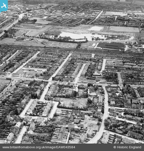
EAW043584 ENGLAND (1952). Residential streets to the north and south of High Road, Chadwell Heath, 1952
© Copyright OpenStreetMap contributors and licensed by the OpenStreetMap Foundation. 2026. Cartography is licensed as CC BY-SA.
Nearby Images (2)
EAW043584

EAW043581

Details
| Title | [EAW043584] Residential streets to the north and south of High Road, Chadwell Heath, 1952 |
| Reference | EAW043584 |
| Date | 4-June-1952 |
| Link | |
| Place name | CHADWELL HEATH |
| Parish | |
| District | |
| Country | ENGLAND |
| Easting / Northing | 548270, 187981 |
| Longitude / Latitude | 0.13969310074875, 51.5707006862 |
| National Grid Reference | TQ483880 |
