
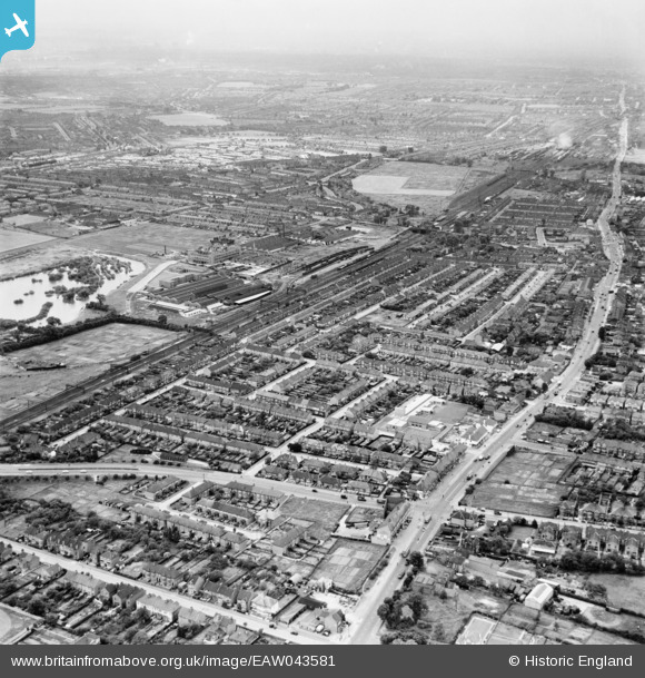
EAW043581 ENGLAND (1952). Streets between High Road, Whalebone Lane South and the railway line, Chadwell Heath, from the north-east, 1952
© Copyright OpenStreetMap contributors and licensed by the OpenStreetMap Foundation. 2026. Cartography is licensed as CC BY-SA.
Nearby Images (2)
EAW043581

EAW043584

Details
| Title | [EAW043581] Streets between High Road, Whalebone Lane South and the railway line, Chadwell Heath, from the north-east, 1952 |
| Reference | EAW043581 |
| Date | 4-June-1952 |
| Link | |
| Place name | CHADWELL HEATH |
| Parish | |
| District | |
| Country | ENGLAND |
| Easting / Northing | 548489, 187956 |
| Longitude / Latitude | 0.14284055836296, 51.570418391731 |
| National Grid Reference | TQ485880 |
Pins

malcolm hannan |
Sunday 13th of August 2017 02:37:50 PM | |
|
malcolm hannan |
Sunday 13th of August 2017 02:37:03 PM | |
|
John Wass |
Tuesday 23rd of June 2015 10:07:33 PM | |
|
rac |
Thursday 7th of August 2014 08:29:28 PM | |
|
rac |
Thursday 7th of August 2014 08:27:23 PM | |
|
Davel |
Monday 16th of June 2014 10:41:54 AM | |
|
Davel |
Monday 16th of June 2014 10:40:23 AM | |
|
Davel |
Thursday 5th of June 2014 02:32:37 PM | |
|
Davel |
Thursday 5th of June 2014 02:29:53 PM | |
|
Davel |
Thursday 5th of June 2014 02:28:03 PM | |
|
Davel |
Thursday 5th of June 2014 02:21:31 PM |