
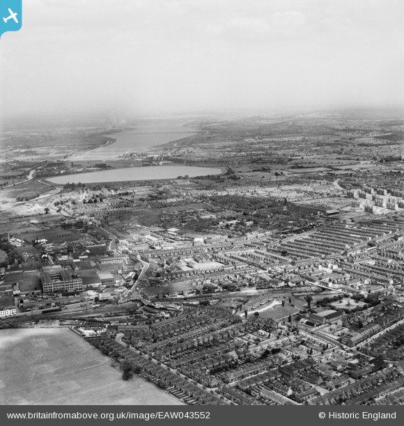
EAW043552 ENGLAND (1952). The area around Blackhorse Road Station and Higham Hill looking towards Banbury Reservoir, from the south, Walthamstow, from the south, 1952
© Copyright OpenStreetMap contributors and licensed by the OpenStreetMap Foundation. 2026. Cartography is licensed as CC BY-SA.
Nearby Images (6)
EAW043552

EAW025750

EAW025746

EAW025748

EPW037546

EPW037545

Details
| Title | [EAW043552] The area around Blackhorse Road Station and Higham Hill looking towards Banbury Reservoir, from the south, Walthamstow, from the south, 1952 |
| Reference | EAW043552 |
| Date | 4-June-1952 |
| Link | |
| Place name | WALTHAMSTOW |
| Parish | |
| District | |
| Country | ENGLAND |
| Easting / Northing | 535966, 189447 |
| Longitude / Latitude | -0.037181767889859, 51.586977811368 |
| National Grid Reference | TQ360894 |
Pins

mozza76 |
Thursday 6th of February 2025 01:26:33 PM | |
|
Dank |
Friday 22nd of March 2019 02:34:04 PM | |
|
Dank |
Friday 22nd of March 2019 02:31:28 PM | |
|
Dank |
Friday 22nd of March 2019 02:27:17 PM | |
|
John Wass |
Saturday 4th of July 2015 03:18:17 PM | |
|
Dank |
Monday 16th of February 2015 10:36:56 AM | |
|
Dank |
Monday 16th of February 2015 09:48:50 AM | |
|
Dank |
Monday 16th of February 2015 09:47:38 AM | |
 |
Dank |
Monday 16th of February 2015 09:45:31 AM |
|
Rod |
Saturday 10th of January 2015 05:27:36 PM | |
|
Rod |
Saturday 10th of January 2015 05:24:30 PM | |
|
Rod |
Saturday 10th of January 2015 05:19:10 PM | |
|
Rod |
Saturday 10th of January 2015 05:18:32 PM | |
|
Rod |
Saturday 10th of January 2015 05:17:57 PM | |
|
Rod |
Saturday 10th of January 2015 05:15:50 PM | |
|
Helga_J |
Friday 25th of July 2014 11:22:55 PM | |
|
Eddy |
Sunday 6th of July 2014 08:23:53 PM | |
|
Eddy |
Sunday 6th of July 2014 08:19:56 PM | |
|
Eddy |
Sunday 6th of July 2014 07:36:34 PM | |
|
Eddy |
Sunday 6th of July 2014 07:35:34 PM | |
|
Eddy |
Sunday 6th of July 2014 07:34:45 PM | |
|
Eddy |
Sunday 6th of July 2014 07:33:35 PM | |
|
Eddy |
Sunday 6th of July 2014 07:32:30 PM | |
|
Eddy |
Sunday 6th of July 2014 07:31:12 PM | |
|
Eddy |
Sunday 6th of July 2014 07:29:56 PM | |
Sorry Eddy, the descriptive should start as at the time of the photograph 1947, this was then the Blackhorse Road Primary & Infants Schools, built in 1903. It became Willowfield School much later in the 1990s. Incidentally, the founder of the Pontins' Holiday Camps, Sir Fred Pontin went to these schools having been born close by near Forest Road. In 2015 the current Willowfield School will be moving into a new building just behind Blackhorse Road Station on the former Warner's Estate head office land. |
 8-2007.JPG)
Keith |
Saturday 15th of November 2014 01:08:15 AM |
|
Eddy |
Sunday 6th of July 2014 07:28:44 PM | |
|
Eddy |
Sunday 6th of July 2014 07:27:32 PM | |
|
Eddy |
Sunday 6th of July 2014 07:26:35 PM |