
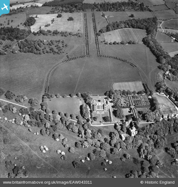
EAW043311 ENGLAND (1952). Hardwick Hall, Hardwick Park, 1952
© Copyright OpenStreetMap contributors and licensed by the OpenStreetMap Foundation. 2026. Cartography is licensed as CC BY-SA.
Nearby Images (3)
EAW043311

EAW043309

EAW043310

Details
| Title | [EAW043311] Hardwick Hall, Hardwick Park, 1952 |
| Reference | EAW043311 |
| Date | 23-May-1952 |
| Link | |
| Place name | HARDWICK PARK |
| Parish | AULT HUCKNALL |
| District | |
| Country | ENGLAND |
| Easting / Northing | 446431, 363765 |
| Longitude / Latitude | -1.3053579594237, 53.16868441376 |
| National Grid Reference | SK464638 |
Pins
Be the first to add a comment to this image!
User Comment Contributions
For more details on the hall, see en.wikipedia.org/wiki/Hardwick_Hall and www.nationaltrust.org.uk/hardwick/ |

melgibbs |
Thursday 21st of August 2014 10:16:28 AM |