
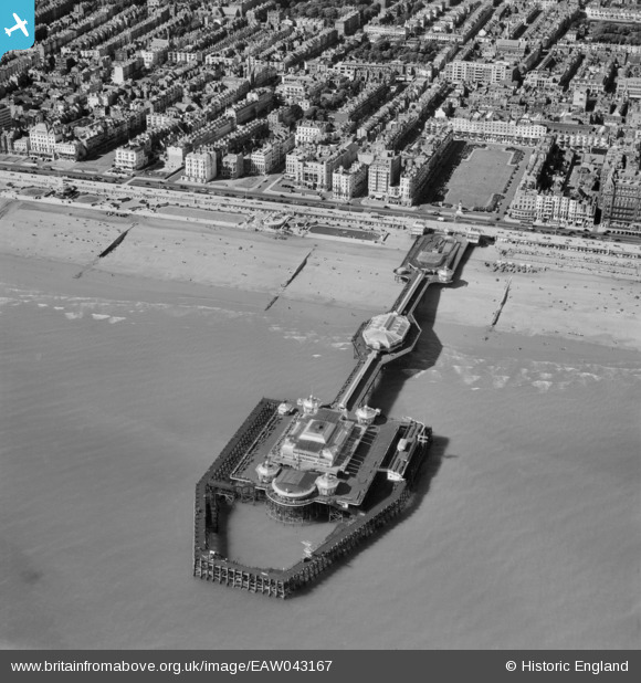
EAW043167 ENGLAND (1952). The West Pier, Brighton, 1952
© Copyright OpenStreetMap contributors and licensed by the OpenStreetMap Foundation. 2026. Cartography is licensed as CC BY-SA.
Nearby Images (29)
EAW043167

EAW022684

EPW000516

EAW022681

EPW000519

EAW011026

EPW045509

EAW022680

EPW011505

EPW045511

EPW017756

EAW022258

EAW022255

EAW022252

EAW022259

EPW039539

EAW022251

EPW039540

EPW000510

EAW022250

EPW000722

EPW041375

EPW054141

EPW000517

EPW017262

EAW022674

EAW006606

EPW054042

EAW006601

Details
| Title | [EAW043167] The West Pier, Brighton, 1952 |
| Reference | EAW043167 |
| Date | 21-May-1952 |
| Link | |
| Place name | BRIGHTON |
| Parish | |
| District | |
| Country | ENGLAND |
| Easting / Northing | 530267, 103943 |
| Longitude / Latitude | -0.15045311616686, 50.819797837783 |
| National Grid Reference | TQ303039 |
Pins

Alan McFaden |
Monday 9th of June 2014 09:23:21 AM | |
|
Alan McFaden |
Monday 9th of June 2014 09:22:03 AM | |
|
Alan McFaden |
Monday 9th of June 2014 09:20:09 AM | |
|
Alan McFaden |
Monday 9th of June 2014 09:18:20 AM | |
|
Alan McFaden |
Monday 9th of June 2014 09:17:15 AM | |
|
Alan McFaden |
Monday 9th of June 2014 09:16:49 AM | |
|
Alan McFaden |
Monday 9th of June 2014 09:15:41 AM | |
|
Alan McFaden |
Monday 9th of June 2014 09:15:02 AM | |
|
Alan McFaden |
Monday 9th of June 2014 09:14:32 AM | |
|
Alan McFaden |
Monday 9th of June 2014 09:14:04 AM | |
|
Alan McFaden |
Monday 9th of June 2014 09:13:31 AM | |
|
Alan McFaden |
Monday 9th of June 2014 09:13:04 AM |


