
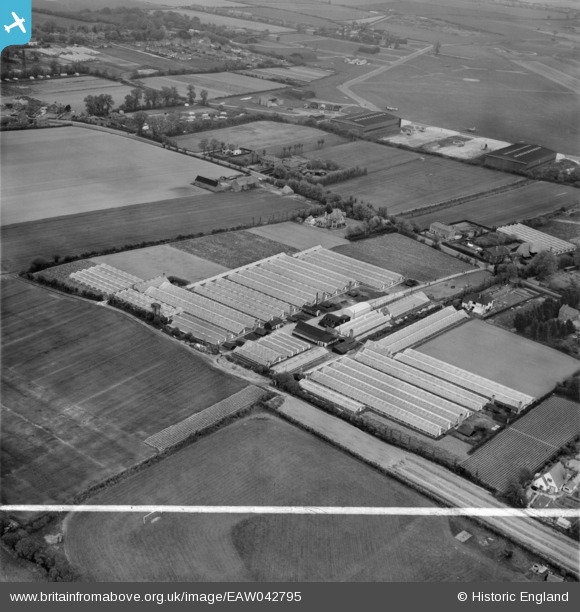
EAW042795 ENGLAND (1952). The Nursery on Stubbington Lane, Stubbington, 1952. This image was marked by Aerofilms Ltd for photo editing.
© Copyright OpenStreetMap contributors and licensed by the OpenStreetMap Foundation. 2026. Cartography is licensed as CC BY-SA.
Nearby Images (14)
EAW042795

EAW042797

EAW042805

EAW042801

EAW042796

EAW042794

EAW042802

EAW042798

EAW042803

EAW042799

EAW042806

EAW042793

EAW042804

EAW042800

Details
| Title | [EAW042795] The Nursery on Stubbington Lane, Stubbington, 1952. This image was marked by Aerofilms Ltd for photo editing. |
| Reference | EAW042795 |
| Date | 30-April-1952 |
| Link | |
| Place name | STUBBINGTON |
| Parish | |
| District | |
| Country | ENGLAND |
| Easting / Northing | 455370, 102113 |
| Longitude / Latitude | -1.2139470436428, 50.815352033487 |
| National Grid Reference | SU554021 |
Pins

Matt Aldred edob.mattaldred.com |
Monday 11th of March 2024 06:26:05 PM | |

ken |
Wednesday 5th of August 2015 08:09:42 PM | |
|
ken |
Wednesday 5th of August 2015 08:09:08 PM | |
|
ken |
Wednesday 5th of August 2015 08:08:18 PM | |
|
ken |
Wednesday 5th of August 2015 08:07:32 PM |