
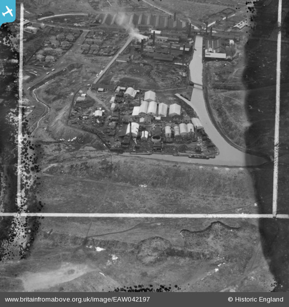
EAW042197 ENGLAND (1952). The W. H. Keys Ltd Hall End Works, Hateley Heath, 1952. This image was marked by Aerofilms Ltd for photo editing.
© Copyright OpenStreetMap contributors and licensed by the OpenStreetMap Foundation. 2026. Cartography is licensed as CC BY-SA.
Nearby Images (33)
EAW042197

EAW042201

EAW042204

EAW042195

EAW042200

EAW042873

EAW042876

EAW042869

EAW042878

EAW042875

EAW042196

EAW042881

EAW042870

EAW042879

EAW042872

EAW042198

EAW042871

EAW042203

EAW042205

EAW042877

EAW042874

EAW042880

EAW042199

EAW042202

EAW048805

EAW020371
 and environs, West Bromwich, 1948")
EAW020369

EAW048802

EAW020370
 and environs, West Bromwich, 1948")
EAW020381
, the Johnson's Iron & Steel Co Ltd Hall End Iron Works and environs, West Bromwich, 1948. This image was marked by Aerofilms Ltd for photo editing.")
EAW020372

EAW048804

EAW020373

Details
| Title | [EAW042197] The W. H. Keys Ltd Hall End Works, Hateley Heath, 1952. This image was marked by Aerofilms Ltd for photo editing. |
| Reference | EAW042197 |
| Date | 3-April-1952 |
| Link | |
| Place name | HATELEY HEATH |
| Parish | |
| District | |
| Country | ENGLAND |
| Easting / Northing | 400036, 292955 |
| Longitude / Latitude | -1.9994692145669, 52.534096557325 |
| National Grid Reference | SP000930 |
Pins

DaveT |
Sunday 27th of April 2014 03:31:05 PM |