
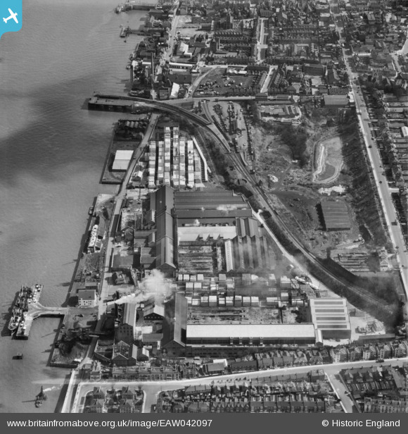
EAW042097 ENGLAND (1952). The Imperial Paper Mills, Gravesend, 1952. This image was marked by Aerofilms Ltd for photo editing.
© Copyright OpenStreetMap contributors and licensed by the OpenStreetMap Foundation. 2026. Cartography is licensed as CC BY-SA.
Nearby Images (6)
EAW042097

EAW042090

EAW042094

EAW042096

EAW042091

EAW042095

Details
| Title | [EAW042097] The Imperial Paper Mills, Gravesend, 1952. This image was marked by Aerofilms Ltd for photo editing. |
| Reference | EAW042097 |
| Date | 27-March-1952 |
| Link | |
| Place name | GRAVESEND |
| Parish | |
| District | |
| Country | ENGLAND |
| Easting / Northing | 564107, 174366 |
| Longitude / Latitude | 0.36170194314877, 51.443984863295 |
| National Grid Reference | TQ641744 |
Pins

Houzi |
Friday 19th of March 2021 12:31:50 AM | |
|
Kentishman |
Sunday 12th of April 2020 04:24:47 PM | |
|
Kentishman |
Friday 5th of September 2014 11:36:55 PM | |
|
Curtisden |
Thursday 24th of July 2014 09:43:41 AM | |
|
Curtisden |
Thursday 24th of July 2014 09:43:19 AM | |
|
Curtisden |
Thursday 24th of July 2014 09:36:26 AM |