
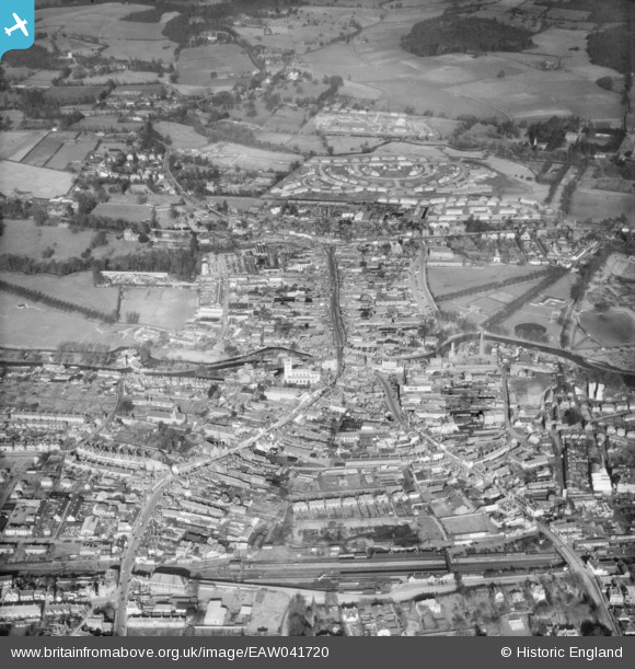
EAW041720 ENGLAND (1952). The town, Newbury, 1952
© Copyright OpenStreetMap contributors and licensed by the OpenStreetMap Foundation. 2026. Cartography is licensed as CC BY-SA.
Nearby Images (8)
EAW041720

EPW011077

EPW054602

EPW011076

EAW015079

EPW059805

EPW022633

EPW022630

Details
| Title | [EAW041720] The town, Newbury, 1952 |
| Reference | EAW041720 |
| Date | 20-February-1952 |
| Link | |
| Place name | NEWBURY |
| Parish | NEWBURY |
| District | |
| Country | ENGLAND |
| Easting / Northing | 447066, 167273 |
| Longitude / Latitude | -1.3233212007536, 51.402037215704 |
| National Grid Reference | SU471673 |
Pins

Andy from Abingdon on Thames |
Tuesday 14th of July 2015 08:46:21 PM |