
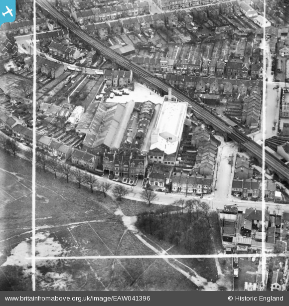
EAW041396 ENGLAND (1951). The H. W. Nevill Ltd Bakery off Harrow Road, Leytonstone, 1951. This image has been produced from a print marked by Aerofilms Ltd for photo editing.
© Copyright OpenStreetMap contributors and licensed by the OpenStreetMap Foundation. 2026. Cartography is licensed as CC BY-SA.
Nearby Images (12)
EAW041396

EAW041405

EAW041399

EAW041395

EAW041402

EAW041398

EAW041397

EAW041401
 off Harrow Road, Leytonstone, 1951. This image has been produced from a damaged negative.")
EAW041403

EAW041394

EAW041400

EAW041404

Details
| Title | [EAW041396] The H. W. Nevill Ltd Bakery off Harrow Road, Leytonstone, 1951. This image has been produced from a print marked by Aerofilms Ltd for photo editing. |
| Reference | EAW041396 |
| Date | 22-November-1951 |
| Link | |
| Place name | LEYTONSTONE |
| Parish | |
| District | |
| Country | ENGLAND |
| Easting / Northing | 539812, 186387 |
| Longitude / Latitude | 0.017084918226156, 51.558536886334 |
| National Grid Reference | TQ398864 |
Pins

Roger |
Thursday 26th of January 2023 01:11:38 AM | |
|
Hermann the German |
Wednesday 6th of September 2017 11:23:51 AM | |
|
Hermann the German |
Wednesday 6th of September 2017 10:51:20 AM | |
|
Hermann the German |
Wednesday 6th of September 2017 10:50:17 AM |