
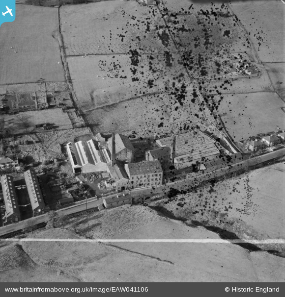
EAW041106 ENGLAND (1951). Broad Clough Cotton Mill, Bacup, 1951. This image has been produced from a damaged negative.
© Copyright OpenStreetMap contributors and licensed by the OpenStreetMap Foundation. 2026. Cartography is licensed as CC BY-SA.
Nearby Images (16)
EAW041106

EAW028432

EAW041110

EAW028433

EAW041107

EAW028434

EAW041108

EAW041105

EAW028428

EAW028430

EAW028429

EAW028431

EAW041113

EAW041109

EAW041111

EAW041112

Details
| Title | [EAW041106] Broad Clough Cotton Mill, Bacup, 1951. This image has been produced from a damaged negative. |
| Reference | EAW041106 |
| Date | 31-October-1951 |
| Link | |
| Place name | BACUP |
| Parish | |
| District | |
| Country | ENGLAND |
| Easting / Northing | 386710, 424127 |
| Longitude / Latitude | -2.2013852420914, 53.713167666995 |
| National Grid Reference | SD867241 |


