
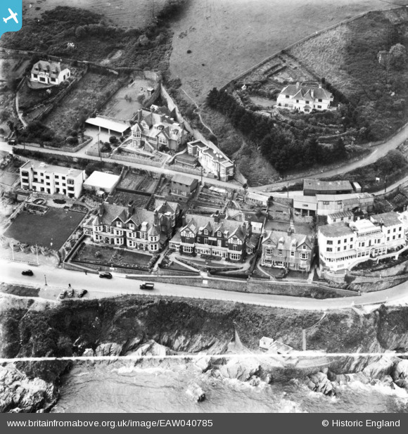
EAW040785 ENGLAND (1951). Hotels along Hannafore Road, Looe, 1951. This image has been produced from a print marked by Aerofilms Ltd for photo editing.
© Copyright OpenStreetMap contributors and licensed by the OpenStreetMap Foundation. 2026. Cartography is licensed as CC BY-SA.
Nearby Images (15)
EAW040785

EAW040790

EAW040788

EAW040786

EAW040784

EAW040787

EAW020275

EAW040789

EAW051358

EAW020247

EAW020248

EAW020250

EAW020246

EAW020249

EAW021374

Details
| Title | [EAW040785] Hotels along Hannafore Road, Looe, 1951. This image has been produced from a print marked by Aerofilms Ltd for photo editing. |
| Reference | EAW040785 |
| Date | 12-October-1951 |
| Link | |
| Place name | LOOE |
| Parish | LOOE |
| District | |
| Country | ENGLAND |
| Easting / Northing | 225668, 52848 |
| Longitude / Latitude | -4.4506866802313, 50.349089209382 |
| National Grid Reference | SX257528 |
Pins

redmist |
Saturday 15th of July 2023 09:56:43 PM | |
 |

Billy Turner |
Friday 30th of September 2016 01:45:21 PM |