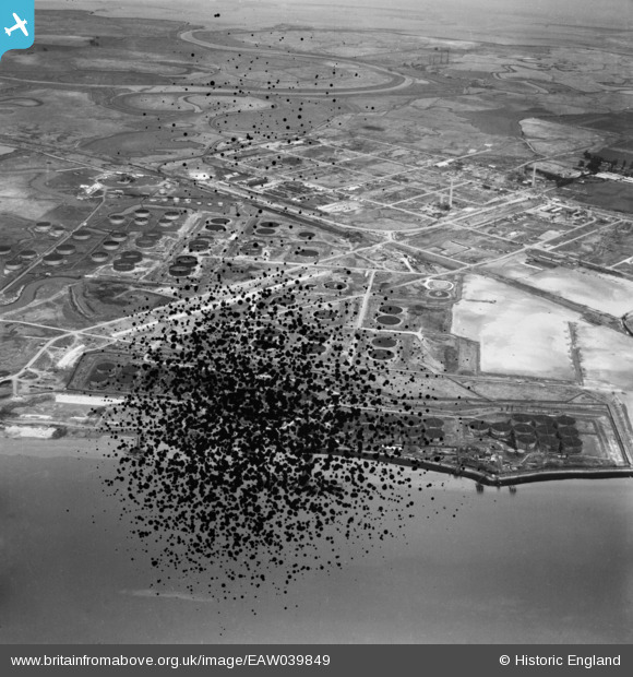
EAW039849 ENGLAND (1951). The Anglo-Iranian Oil Co oil refinery under construction, Isle of Grain, from the south, 1951. This image has been produced from a damaged negative.
© Copyright OpenStreetMap contributors and licensed by the OpenStreetMap Foundation. 2025. Cartography is licensed as CC BY-SA.
Details
| Title | [EAW039849] The Anglo-Iranian Oil Co oil refinery under construction, Isle of Grain, from the south, 1951. This image has been produced from a damaged negative. |
| Reference | EAW039849 |
| Date | 20-August-1951 |
| Link | |
| Place name | ISLE OF GRAIN |
| Parish | ISLE OF GRAIN |
| District | |
| Country | ENGLAND |
| Easting / Northing | 586871, 173928 |
| Longitude / Latitude | 0.68870862094898, 51.432997443011 |
| National Grid Reference | TQ869739 |
Pins

redmist |
Monday 24th of January 2022 09:47:16 PM | |

Matt Aldred edob.mattaldred.com |
Thursday 3rd of December 2020 09:12:15 PM | |

redmist |
Sunday 21st of June 2020 10:36:33 PM | |

cptpies |
Thursday 8th of May 2014 11:10:41 AM |


![[EAW039849] The Anglo-Iranian Oil Co oil refinery under construction, Isle of Grain, from the south, 1951. This image has been produced from a damaged negative.](http://britainfromabove.org.uk/sites/all/libraries/aerofilms-images/public/100x100/EAW/039/EAW039849.jpg)
![[EAW034849] The Anglo-Iranian Oil Co oil refinery under construction, Isle of Grain, from the south, 1951. This image has been produced from a print.](http://britainfromabove.org.uk/sites/all/libraries/aerofilms-images/public/100x100/EAW/034/EAW034849.jpg)