
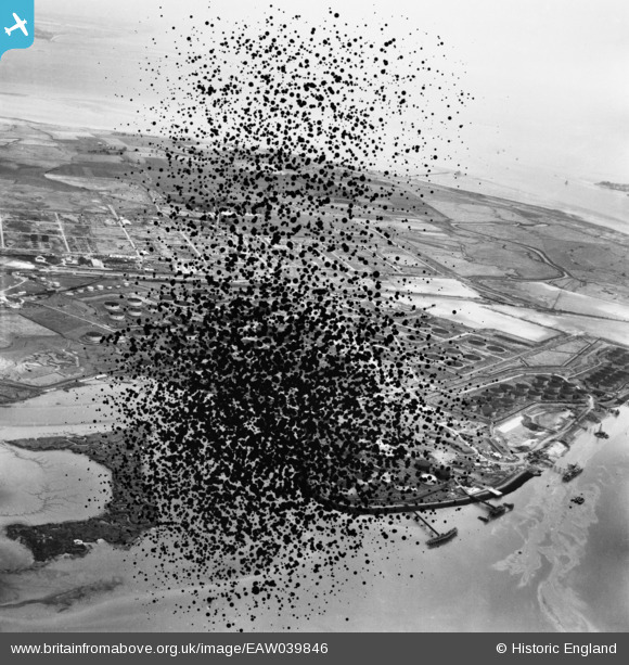
EAW039846 ENGLAND (1951). The Anglo-Iranian Oil Co oil refinery under construction, Isle of Grain, from the south-west, 1951. This image has been produced from a damaged negative.
© Copyright OpenStreetMap contributors and licensed by the OpenStreetMap Foundation. 2026. Cartography is licensed as CC BY-SA.
Nearby Images (11)
EAW039846

EPW013213

EAW034848

EPW013209

EPW013214

EAW021076

EPW013216

EAW039845

EAW034847

EPW013204

EAW039844

Details
| Title | [EAW039846] The Anglo-Iranian Oil Co oil refinery under construction, Isle of Grain, from the south-west, 1951. This image has been produced from a damaged negative. |
| Reference | EAW039846 |
| Date | 20-August-1951 |
| Link | |
| Place name | ISLE OF GRAIN |
| Parish | ISLE OF GRAIN |
| District | |
| Country | ENGLAND |
| Easting / Northing | 585941, 174073 |
| Longitude / Latitude | 0.67541959134094, 51.434605927659 |
| National Grid Reference | TQ859741 |
Pins

Matt Aldred edob.mattaldred.com |
Monday 8th of March 2021 01:28:10 PM | |

redmist |
Sunday 21st of June 2020 10:29:45 PM |