
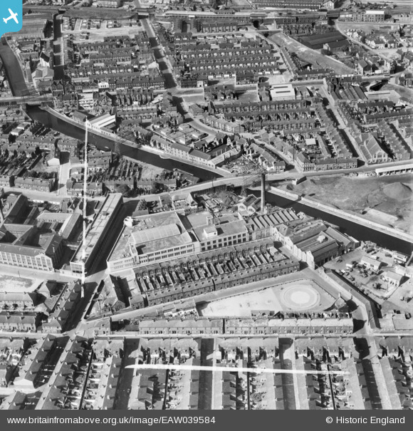
EAW039584 ENGLAND (1951). The Williams Toffee Works and the surrounding area, Bootle, 1951. This image was marked by Aerofilms Ltd for photo editing.
© Copyright OpenStreetMap contributors and licensed by the OpenStreetMap Foundation. 2026. Cartography is licensed as CC BY-SA.
Nearby Images (9)
EAW039584

EAW039583

EAW039586

EAW039580

EAW039581

EAW039585

EAW039582

EAW043747

EAW043746

Details
| Title | [EAW039584] The Williams Toffee Works and the surrounding area, Bootle, 1951. This image was marked by Aerofilms Ltd for photo editing. |
| Reference | EAW039584 |
| Date | 9-September-1951 |
| Link | |
| Place name | BOOTLE |
| Parish | |
| District | |
| Country | ENGLAND |
| Easting / Northing | 334536, 395551 |
| Longitude / Latitude | -2.985911809314, 53.452389945612 |
| National Grid Reference | SJ345956 |
Pins

bob |
Wednesday 16th of July 2025 09:55:18 AM | |
|
Oxo |
Thursday 23rd of January 2025 10:02:31 PM | |
|
Oxo |
Thursday 23rd of January 2025 10:01:00 PM | |
|
rivermersey |
Sunday 14th of January 2024 09:35:14 PM | |
|
rivermersey |
Sunday 14th of January 2024 09:26:10 PM | |
|
bob |
Monday 10th of June 2019 03:12:38 PM | |
|
bob |
Monday 10th of June 2019 03:11:58 PM | |
|
Linda |
Thursday 4th of September 2014 05:42:13 PM | |
|
Linda |
Thursday 4th of September 2014 05:41:06 PM | |
|
Linda |
Thursday 4th of September 2014 05:38:47 PM | |
|
Linda |
Thursday 4th of September 2014 05:37:33 PM | |
|
Linda |
Thursday 4th of September 2014 05:36:00 PM | |
|
bootlegirl |
Thursday 5th of June 2014 10:22:49 AM | |
|
bootlegirl |
Thursday 5th of June 2014 10:22:00 AM |