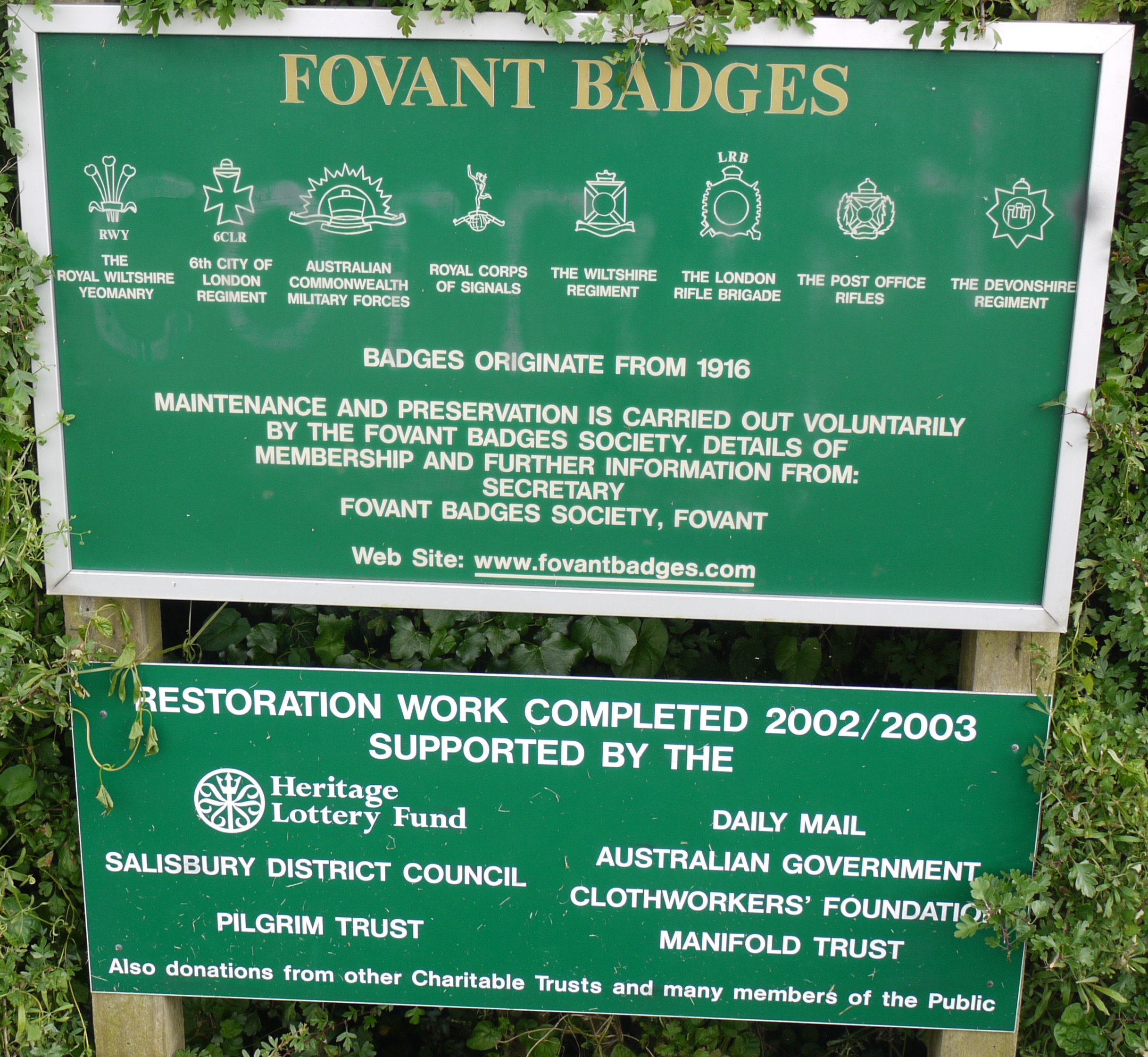
EAW038619 ENGLAND (1951). Chiselbury Camp hillfort and the Fovant Badges, Fovant, 1951

© Copyright OpenStreetMap contributors and licensed by the OpenStreetMap Foundation. 2026. Cartography is licensed as CC BY-SA.
Nearby Images (10)
EAW038619

EAW031927

EAW038618

EAW031929

EAW051994

EAW051995

EAW051990

EAW031930

EAW051989

EAW005105

Details
| Title | [EAW038619] Chiselbury Camp hillfort and the Fovant Badges, Fovant, 1951 |
| Reference | EAW038619 |
| Date | 13-August-1951 |
| Link | |
| Place name | FOVANT |
| Parish | FOVANT |
| District | |
| Country | ENGLAND |
| Easting / Northing | 401539, 128367 |
| Longitude / Latitude | -1.9780397687387, 51.054109837693 |
| National Grid Reference | SU015284 |
Pins

wayfarer |
Friday 20th of February 2015 04:27:30 PM |