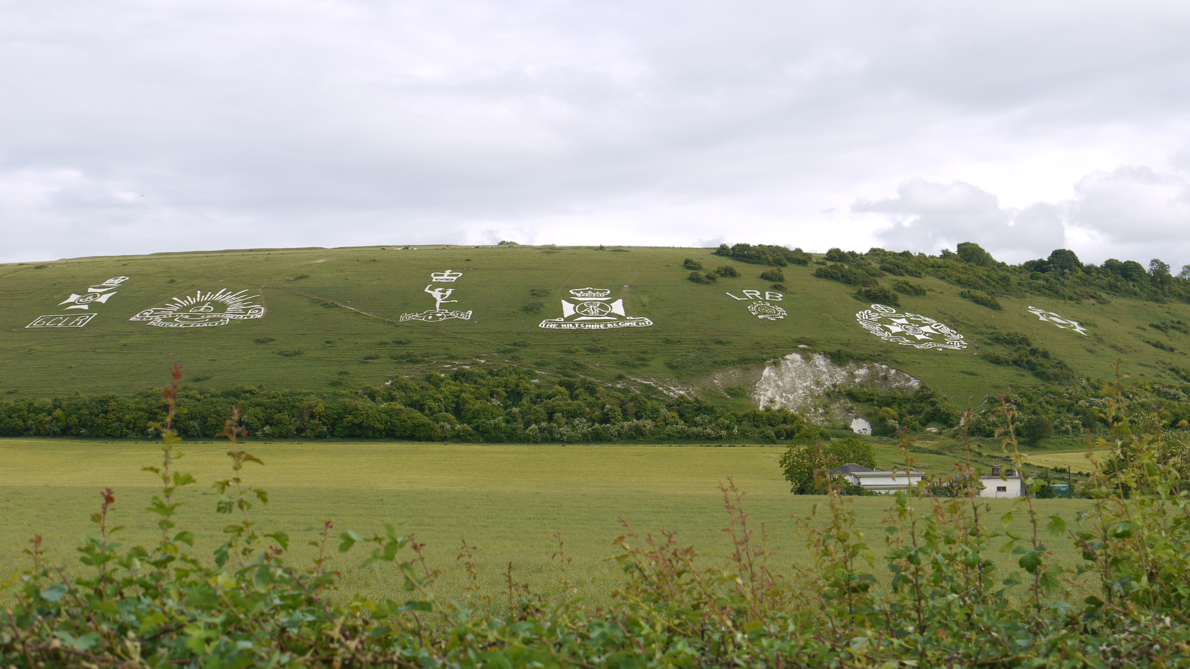
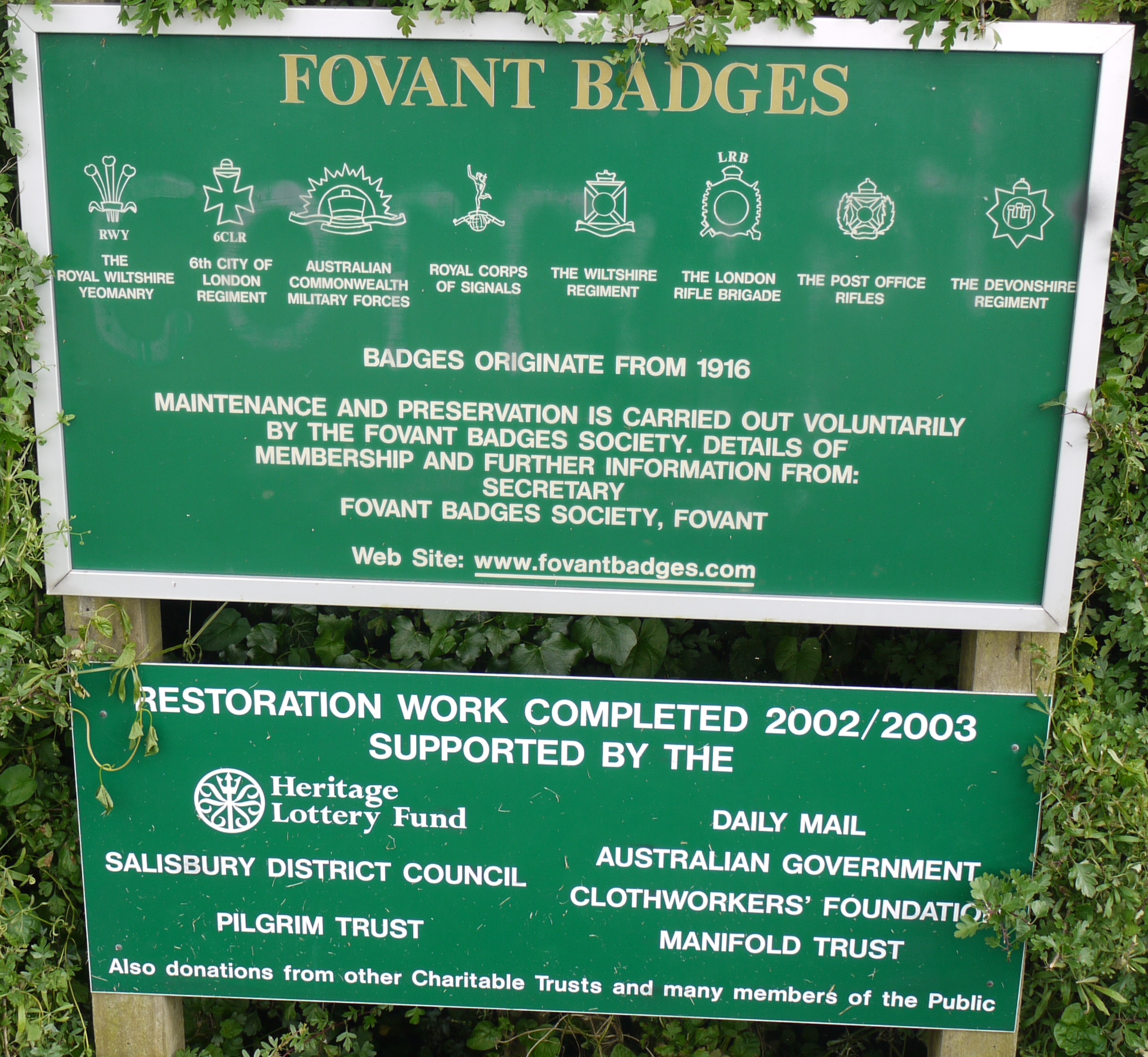
EAW005105 ENGLAND (1947). Chiselbury Camp hillfort and the Fovant Badges, Fovant, 1947

© Copyright OpenStreetMap contributors and licensed by the OpenStreetMap Foundation. 2026. Cartography is licensed as CC BY-SA.
Nearby Images (9)
EAW005105

EAW005104

EAW051989

EAW031929

EAW031930

EAW051990

EAW031927

EAW038619

EAW038618

Details
| Title | [EAW005105] Chiselbury Camp hillfort and the Fovant Badges, Fovant, 1947 |
| Reference | EAW005105 |
| Date | 7-September-1947 |
| Link | |
| Place name | FOVANT |
| Parish | FOVANT |
| District | |
| Country | ENGLAND |
| Easting / Northing | 401783, 128153 |
| Longitude / Latitude | -1.9745591494961, 51.052184588222 |
| National Grid Reference | SU018282 |
Pins
Be the first to add a comment to this image!