
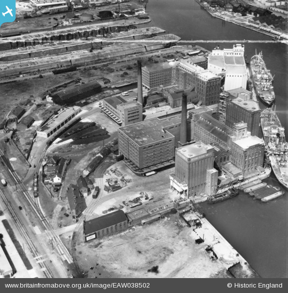
EAW038502 ENGLAND (1951). The Joseph Rank Ltd Ocean Flour Mills alongside Spillers Flour Mill, Poulton, 1951. This image has been produced from a print marked by Aerofilms Ltd for photo editing.
© Copyright OpenStreetMap contributors and licensed by the OpenStreetMap Foundation. 2026. Cartography is licensed as CC BY-SA.
Nearby Images (20)
EAW038502

EAW038500

EAW036052

EAW038508

EAW036048

EAW036053

EAW038501

EAW038505

EAW036050

EAW038507

EAW036054

EAW036051

EAW038504

EAW038503

EAW036049

EAW038506

EAW001724

EPW041994

EPW041997

EPW041995

Details
| Title | [EAW038502] The Joseph Rank Ltd Ocean Flour Mills alongside Spillers Flour Mill, Poulton, 1951. This image has been produced from a print marked by Aerofilms Ltd for photo editing. |
| Reference | EAW038502 |
| Date | 1-August-1951 |
| Link | |
| Place name | POULTON |
| Parish | |
| District | |
| Country | ENGLAND |
| Easting / Northing | 330396, 390166 |
| Longitude / Latitude | -3.0470604490483, 53.403458495722 |
| National Grid Reference | SJ304902 |
