
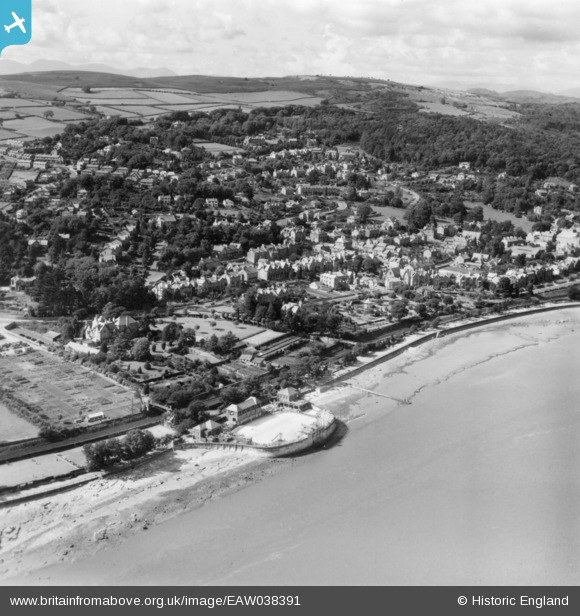
EAW038391 ENGLAND (1951). The town, Grange-Over-Sands, from the south-east, 1951. This image has been produced from a print.
© Copyright OpenStreetMap contributors and licensed by the OpenStreetMap Foundation. 2026. Cartography is licensed as CC BY-SA.
Nearby Images (2)
EAW038391

EAW038392

Details
| Title | [EAW038391] The town, Grange-Over-Sands, from the south-east, 1951. This image has been produced from a print. |
| Reference | EAW038391 |
| Date | 6-August-1951 |
| Link | |
| Place name | GRANGE-OVER-SANDS |
| Parish | GRANGE-OVER-SANDS |
| District | |
| Country | ENGLAND |
| Easting / Northing | 340581, 477236 |
| Longitude / Latitude | -2.9106665810807, 54.187280073327 |
| National Grid Reference | SD406772 |
Pins
Be the first to add a comment to this image!