
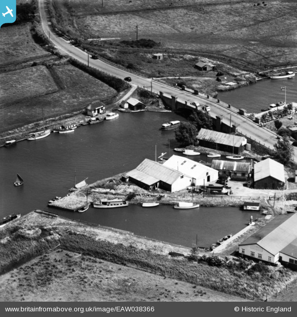
EAW038366 ENGLAND (1951). Acle Bridge, Acle, 1951. This image has been produced from a print.
© Copyright OpenStreetMap contributors and licensed by the OpenStreetMap Foundation. 2026. Cartography is licensed as CC BY-SA.
Nearby Images (2)
EAW038366

EAW038365

Details
| Title | [EAW038366] Acle Bridge, Acle, 1951. This image has been produced from a print. |
| Reference | EAW038366 |
| Date | 3-August-1951 |
| Link | |
| Place name | ACLE |
| Parish | ACLE |
| District | |
| Country | ENGLAND |
| Easting / Northing | 641429, 311662 |
| Longitude / Latitude | 1.5695304702989, 52.648508141689 |
| National Grid Reference | TG414117 |
Pins

Matt Aldred edob.mattaldred.com |
Monday 8th of March 2021 03:11:46 PM | |

Andy |
Monday 22nd of February 2016 09:35:13 PM | |
|
ken |
Saturday 25th of July 2015 07:29:11 PM | |
|
cptpies |
Friday 21st of November 2014 01:43:29 PM |
User Comment Contributions

Type 22 Pillbox at Acle Bridge |
cptpies |
Friday 21st of November 2014 01:44:44 PM |