
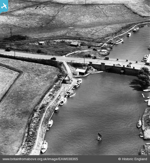
EAW038365 ENGLAND (1951). Acle Bridge, Acle, 1951. This image has been produced from a print.
© Copyright OpenStreetMap contributors and licensed by the OpenStreetMap Foundation. 2026. Cartography is licensed as CC BY-SA.
Nearby Images (2)
EAW038365

EAW038366

Details
| Title | [EAW038365] Acle Bridge, Acle, 1951. This image has been produced from a print. |
| Reference | EAW038365 |
| Date | 3-August-1951 |
| Link | |
| Place name | ACLE |
| Parish | ACLE |
| District | |
| Country | ENGLAND |
| Easting / Northing | 641432, 311657 |
| Longitude / Latitude | 1.5695710735294, 52.648461940303 |
| National Grid Reference | TG414117 |
Pins

cptpies |
Friday 21st of November 2014 01:41:51 PM |
User Comment Contributions

Type 22 Pillbox at Acle Bridge |
cptpies |
Friday 21st of November 2014 01:42:57 PM |