
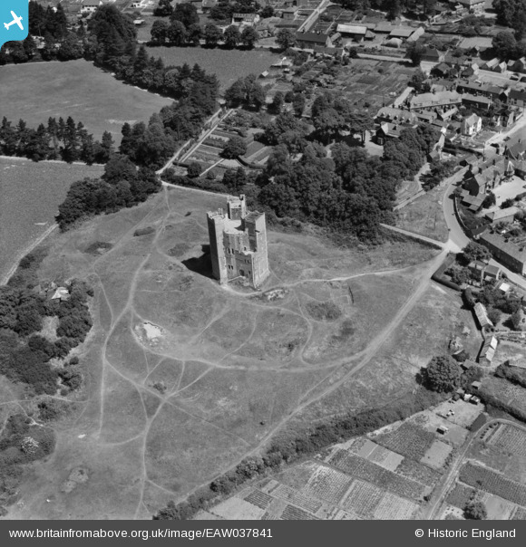
EAW037841 ENGLAND (1951). The castle, Orford, 1951
© Copyright OpenStreetMap contributors and licensed by the OpenStreetMap Foundation. 2026. Cartography is licensed as CC BY-SA.
Nearby Images (9)
EAW037841

EAW038350

EAW037843

EAW038351

EAW037842

EAW037840

EAW037838

EAW025908

EAW025907

Details
| Title | [EAW037841] The castle, Orford, 1951 |
| Reference | EAW037841 |
| Date | 17-July-1951 |
| Link | |
| Place name | ORFORD |
| Parish | ORFORD |
| District | |
| Country | ENGLAND |
| Easting / Northing | 641948, 249863 |
| Longitude / Latitude | 1.532607834288, 52.093701479469 |
| National Grid Reference | TM419499 |
Pins

Chris Kolonko |
Monday 5th of February 2018 02:21:14 PM |