
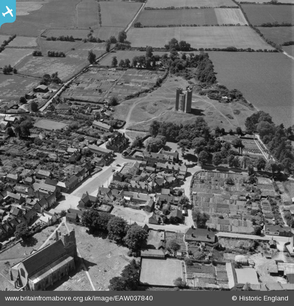
EAW037840 ENGLAND (1951). The castle, St Bartholomew's Church and Market Hill, Orford, 1951
© Copyright OpenStreetMap contributors and licensed by the OpenStreetMap Foundation. 2026. Cartography is licensed as CC BY-SA.
Nearby Images (10)
EAW037840

EAW037838

EAW037842

EAW038351

EAW037843

EAW037841

EAW038350

EAW025908

EAW025907

EAW037839

Details
| Title | [EAW037840] The castle, St Bartholomew's Church and Market Hill, Orford, 1951 |
| Reference | EAW037840 |
| Date | 17-July-1951 |
| Link | |
| Place name | ORFORD |
| Parish | ORFORD |
| District | |
| Country | ENGLAND |
| Easting / Northing | 642046, 249909 |
| Longitude / Latitude | 1.5340684182172, 52.094071457186 |
| National Grid Reference | TM420499 |
Pins
Be the first to add a comment to this image!