
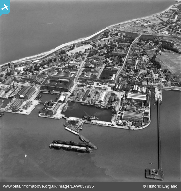
EAW037835 ENGLAND (1951). The docks and Blue Town, Sheerness, 1951. This image has been produced from a print.
© Copyright OpenStreetMap contributors and licensed by the OpenStreetMap Foundation. 2026. Cartography is licensed as CC BY-SA.
Nearby Images (7)
EAW037835

EAW009062

EAW021075

EAW037833

EAW037832

EAW009061

EAW037834

Details
| Title | [EAW037835] The docks and Blue Town, Sheerness, 1951. This image has been produced from a print. |
| Reference | EAW037835 |
| Date | 17-July-1951 |
| Link | |
| Place name | SHEERNESS |
| Parish | |
| District | |
| Country | ENGLAND |
| Easting / Northing | 590984, 175107 |
| Longitude / Latitude | 0.74845026134453, 51.442216047056 |
| National Grid Reference | TQ910751 |
Pins

bargee1937 |
Tuesday 10th of November 2015 02:00:14 PM |