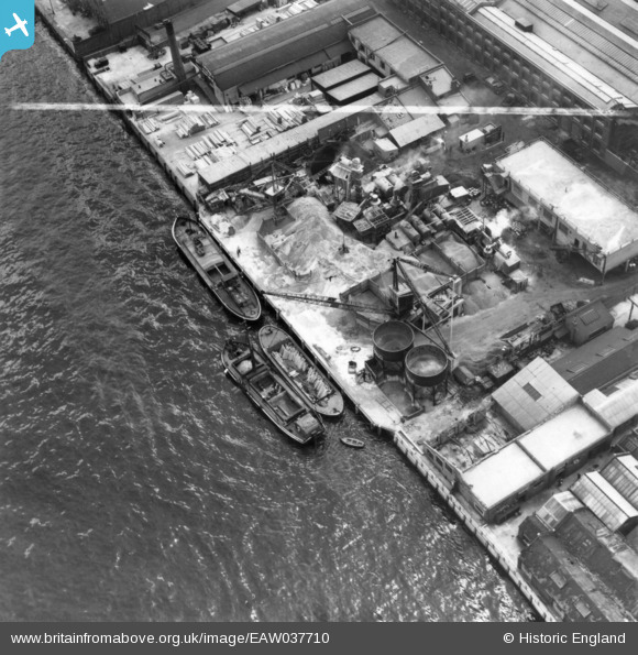
EAW037710 ENGLAND (1951). Long's Wharf, Woolwich, 1951. This image has been produced from a print marked by Aerofilms Ltd for photo editing.
© Copyright OpenStreetMap contributors and licensed by the OpenStreetMap Foundation. 2026. Cartography is licensed as CC BY-SA.
Nearby Images (9)
Details
| Title | [EAW037710] Long's Wharf, Woolwich, 1951. This image has been produced from a print marked by Aerofilms Ltd for photo editing. |
| Reference | EAW037710 |
| Date | 16-July-1951 |
| Link | |
| Place name | WOOLWICH |
| Parish | |
| District | |
| Country | ENGLAND |
| Easting / Northing | 541933, 179346 |
| Longitude / Latitude | 0.044826484531106, 51.494731555583 |
| National Grid Reference | TQ419793 |
Pins
Be the first to add a comment to this image!


![[EAW037710] Long's Wharf, Woolwich, 1951. This image has been produced from a print marked by Aerofilms Ltd for photo editing.](http://britainfromabove.org.uk/sites/all/libraries/aerofilms-images/public/100x100/EAW/037/EAW037710.jpg)
![[EAW037713] Long's Wharf, Woolwich, 1951. This image has been produced from a print marked by Aerofilms Ltd for photo editing.](http://britainfromabove.org.uk/sites/all/libraries/aerofilms-images/public/100x100/EAW/037/EAW037713.jpg)
![[EAW037716] Long's Wharf, Woolwich, 1951. This image has been produced from a print marked by Aerofilms Ltd for photo editing.](http://britainfromabove.org.uk/sites/all/libraries/aerofilms-images/public/100x100/EAW/037/EAW037716.jpg)
![[EAW037712] Long's Wharf, Woolwich, 1951. This image has been produced from a print marked by Aerofilms Ltd for photo editing.](http://britainfromabove.org.uk/sites/all/libraries/aerofilms-images/public/100x100/EAW/037/EAW037712.jpg)
![[EAW037711] Long's Wharf, Woolwich, 1951. This image has been produced from a print marked by Aerofilms Ltd for photo editing.](http://britainfromabove.org.uk/sites/all/libraries/aerofilms-images/public/100x100/EAW/037/EAW037711.jpg)
![[EAW037715] Long's Wharf, Woolwich, 1951. This image has been produced from a print marked by Aerofilms Ltd for photo editing.](http://britainfromabove.org.uk/sites/all/libraries/aerofilms-images/public/100x100/EAW/037/EAW037715.jpg)
![[EPW057658] The Siemens Brothers and Co Works alongside the River Thames, New Charlton, 1938. This image has been produced from a damaged negative.](http://britainfromabove.org.uk/sites/all/libraries/aerofilms-images/public/100x100/EPW/057/EPW057658.jpg)
![[EPW060544] Maryon Park, Woolwich Riverside and the site of the Thames Flood Barrier, Charlton, 1939](http://britainfromabove.org.uk/sites/all/libraries/aerofilms-images/public/100x100/EPW/060/EPW060544.jpg)
![[EPW057659] The Siemens Brothers and Co Works alongside the River Thames, New Charlton, 1938. This image has been produced from a damaged negative.](http://britainfromabove.org.uk/sites/all/libraries/aerofilms-images/public/100x100/EPW/057/EPW057659.jpg)