
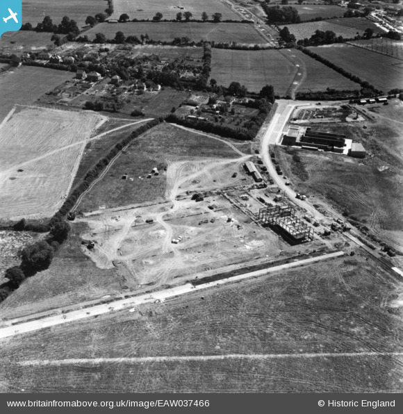
EAW037466 ENGLAND (1951). Factory buildings under construction off Maylands Avenue, Adeyfield, 1951. This image has been produced from a print marked by Aerofilms Ltd for photo editing.
© Copyright OpenStreetMap contributors and licensed by the OpenStreetMap Foundation. 2026. Cartography is licensed as CC BY-SA.
Nearby Images (39)
EAW037466

EAW048145

EAW048146

EAW048139

EAW048149

EAW048140

EAW048142

EAW048141

EAW048144

EAW048143

EAW042013

EAW048148

EAW048147

EAW042004

EAW042015

EAW042010

EAW042001

EAW042006

EAW037474

EAW048150

EAW042005

EAW037468

EAW042008

EAW042002

EAW037472

EAW042009

EAW042012

EAW037464

EAW037467

EAW037469

EAW042014

EAW037471

EAW042000

EAW037470

EAW042007

EAW042011

EAW042003

EAW037465

EAW049424

Details
| Title | [EAW037466] Factory buildings under construction off Maylands Avenue, Adeyfield, 1951. This image has been produced from a print marked by Aerofilms Ltd for photo editing. |
| Reference | EAW037466 |
| Date | 2-July-1951 |
| Link | |
| Place name | ADEYFIELD |
| Parish | |
| District | |
| Country | ENGLAND |
| Easting / Northing | 507921, 208166 |
| Longitude / Latitude | -0.43607341905707, 51.761311894819 |
| National Grid Reference | TL079082 |
Pins
Be the first to add a comment to this image!