
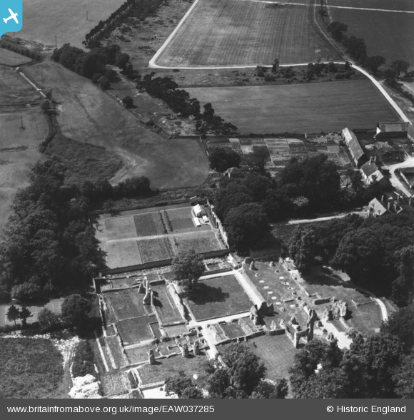
EAW037285 ENGLAND (1951). St Mary's Priory, Thetford, 1951. This image has been produced from a print.
© Copyright OpenStreetMap contributors and licensed by the OpenStreetMap Foundation. 2026. Cartography is licensed as CC BY-SA.
Nearby Images (6)
EAW037285

EAW037286

EAW037283

EAW002913

EAW037287

EAW037284

Details
| Title | [EAW037285] St Mary's Priory, Thetford, 1951. This image has been produced from a print. |
| Reference | EAW037285 |
| Date | 21-June-1951 |
| Link | |
| Place name | THETFORD |
| Parish | THETFORD |
| District | |
| Country | ENGLAND |
| Easting / Northing | 586521, 283396 |
| Longitude / Latitude | 0.74300875719954, 52.416328857479 |
| National Grid Reference | TL865834 |
Pins

redmist |
Friday 16th of August 2024 08:36:38 PM |