
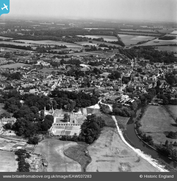
EAW037283 ENGLAND (1951). St Mary's Priory and the town, Thetford, from the west, 1951. This image has been produced from a print.
© Copyright OpenStreetMap contributors and licensed by the OpenStreetMap Foundation. 2026. Cartography is licensed as CC BY-SA.
Nearby Images (7)
EAW037283

EAW037287

EAW037285

EAW037286

EAW037284

EAW002913

EAW037288

Details
| Title | [EAW037283] St Mary's Priory and the town, Thetford, from the west, 1951. This image has been produced from a print. |
| Reference | EAW037283 |
| Date | 21-June-1951 |
| Link | |
| Place name | THETFORD |
| Parish | THETFORD |
| District | |
| Country | ENGLAND |
| Easting / Northing | 586542, 283316 |
| Longitude / Latitude | 0.74327258486902, 52.415603233112 |
| National Grid Reference | TL865833 |
Pins

Matt Aldred edob.mattaldred.com |
Monday 7th of September 2020 09:05:34 PM | |

jrussill |
Tuesday 29th of March 2016 11:46:46 AM | |
|
d.osborne |
Sunday 10th of May 2015 02:35:15 PM | |
|
d.osborne |
Sunday 10th of May 2015 02:34:01 PM |
User Comment Contributions

SPIGOT MORTAR EMPLACEMENT |
jrussill |
Tuesday 29th of March 2016 12:03:02 PM |