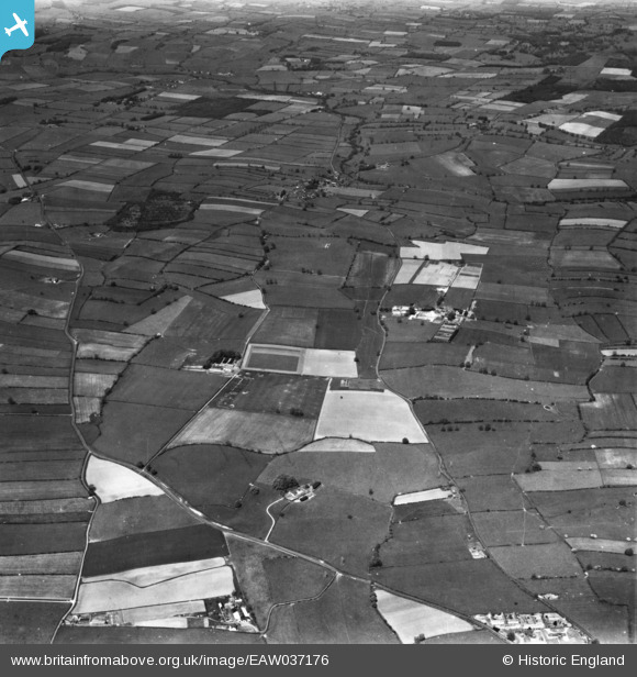
EAW037176 ENGLAND (1951). Sewborwens Farm, Newton Rigg Farm School and surrounding countryside, Newton Rigg, 1951. This image has been produced from a print.
© Copyright OpenStreetMap contributors and licensed by the OpenStreetMap Foundation. 2025. Cartography is licensed as CC BY-SA.
Nearby Images (7)
Details
| Title | [EAW037176] Sewborwens Farm, Newton Rigg Farm School and surrounding countryside, Newton Rigg, 1951. This image has been produced from a print. |
| Reference | EAW037176 |
| Date | 5-June-1951 |
| Link | |
| Place name | NEWTON RIGG |
| Parish | CATTERLEN |
| District | |
| Country | ENGLAND |
| Easting / Northing | 349068, 530683 |
| Longitude / Latitude | -2.7897917618499, 54.668533270641 |
| National Grid Reference | NY491307 |


![[EAW037176] Sewborwens Farm, Newton Rigg Farm School and surrounding countryside, Newton Rigg, 1951. This image has been produced from a print.](http://britainfromabove.org.uk/sites/all/libraries/aerofilms-images/public/100x100/EAW/037/EAW037176.jpg)
![[EAW037175] Sewborwens Farm, Newton Rigg Farm School and surrounding countryside, Newton Rigg, 1951. This image has been produced from a print.](http://britainfromabove.org.uk/sites/all/libraries/aerofilms-images/public/100x100/EAW/037/EAW037175.jpg)
![[EAW037173] Sewborwens Farm, Newton Rigg Farm School and surrounding countryside, Newton Rigg, 1951. This image has been produced from a print.](http://britainfromabove.org.uk/sites/all/libraries/aerofilms-images/public/100x100/EAW/037/EAW037173.jpg)
![[EAW037168] Sewborwens Farm, Newton Rigg Farm School and surrounding countryside, Newton Rigg, 1951. This image has been produced from a print marked by Aerofilms Ltd for photo editing.](http://britainfromabove.org.uk/sites/all/libraries/aerofilms-images/public/100x100/EAW/037/EAW037168.jpg)
![[EAW037167] Newton Rigg Farm School, Newton Rigg, from the south, 1951. This image has been produced from a print marked by Aerofilms Ltd for photo editing.](http://britainfromabove.org.uk/sites/all/libraries/aerofilms-images/public/100x100/EAW/037/EAW037167.jpg)
![[EAW037164] Newton Rigg Farm School, Newton Rigg, 1951. This image has been produced from a print marked by Aerofilms Ltd for photo editing.](http://britainfromabove.org.uk/sites/all/libraries/aerofilms-images/public/100x100/EAW/037/EAW037164.jpg)
![[EAW037166] Newton Rigg Farm School, Newton Rigg, 1951. This image has been produced from a print marked by Aerofilms Ltd for photo editing.](http://britainfromabove.org.uk/sites/all/libraries/aerofilms-images/public/100x100/EAW/037/EAW037166.jpg)
