
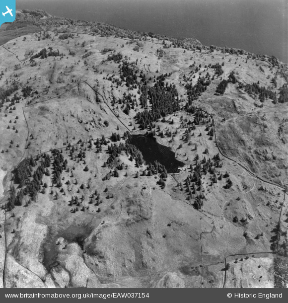
EAW037154 ENGLAND (1951). Three Dubs Tarn, Claife Heights, 1951. This image has been produced from a print.
© Copyright OpenStreetMap contributors and licensed by the OpenStreetMap Foundation. 2026. Cartography is licensed as CC BY-SA.
Nearby Images (7)
EAW037154

EAW035890

EAW037155

EAW035891

EAW035889

EAW046938

EAW046946

Details
| Title | [EAW037154] Three Dubs Tarn, Claife Heights, 1951. This image has been produced from a print. |
| Reference | EAW037154 |
| Date | 5-June-1951 |
| Link | |
| Place name | CLAIFE HEIGHTS |
| Parish | CLAIFE |
| District | |
| Country | ENGLAND |
| Easting / Northing | 337813, 497403 |
| Longitude / Latitude | -2.9572752830307, 54.368193662744 |
| National Grid Reference | SD378974 |
Pins
Be the first to add a comment to this image!