
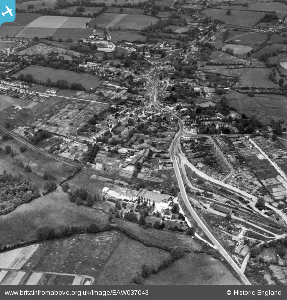
EAW037043 ENGLAND (1951). The town, Great Dunmow, 1951. This image has been produced from a print.
© Copyright OpenStreetMap contributors and licensed by the OpenStreetMap Foundation. 2026. Cartography is licensed as CC BY-SA.
Nearby Images (8)
EAW037043

EAW021040

EAW037044

EPW025009

EPW025007

EAW021039

EAW042129

EAW042130

Details
| Title | [EAW037043] The town, Great Dunmow, 1951. This image has been produced from a print. |
| Reference | EAW037043 |
| Date | 6-July-1951 |
| Link | |
| Place name | GREAT DUNMOW |
| Parish | GREAT DUNMOW |
| District | |
| Country | ENGLAND |
| Easting / Northing | 562911, 221600 |
| Longitude / Latitude | 0.36651847530186, 51.868711680362 |
| National Grid Reference | TL629216 |
Pins
Be the first to add a comment to this image!