
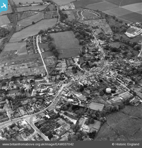
EAW037042 ENGLAND (1951). The town, Great Dunmow, 1951. This image has been produced from a print.
© Copyright OpenStreetMap contributors and licensed by the OpenStreetMap Foundation. 2026. Cartography is licensed as CC BY-SA.
Nearby Images (6)
EAW037042

EAW042130

EAW042129

EPW025008

EAW021039

EAW021038

Details
| Title | [EAW037042] The town, Great Dunmow, 1951. This image has been produced from a print. |
| Reference | EAW037042 |
| Date | 6-July-1951 |
| Link | |
| Place name | GREAT DUNMOW |
| Parish | GREAT DUNMOW |
| District | |
| Country | ENGLAND |
| Easting / Northing | 562750, 221851 |
| Longitude / Latitude | 0.36430017755996, 51.871013732425 |
| National Grid Reference | TL628219 |
Pins
Be the first to add a comment to this image!