
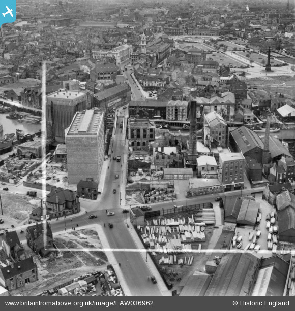
EAW036962 ENGLAND (1951). Joseph Rank Ltd Clarence Corn Mills, Kingston upon Hull, 1951. This image has been produced from a print marked by Aerofilms Ltd for photo editing.
© Copyright OpenStreetMap contributors and licensed by the OpenStreetMap Foundation. 2026. Cartography is licensed as CC BY-SA.
Nearby Images (19)
EAW036962

EAW036970

EAW036966

EAW036963

EAW036973

EAW036861

EPW009378

EAW036971

EPW012700

EAW036968

EAW036969

EAW036967

EAW036965

EAW036972

EAW036964

EPW036505

EAW046137

EAW015646

EPW055046

Details
| Title | [EAW036962] Joseph Rank Ltd Clarence Corn Mills, Kingston upon Hull, 1951. This image has been produced from a print marked by Aerofilms Ltd for photo editing. |
| Reference | EAW036962 |
| Date | 7-June-1951 |
| Link | |
| Place name | KINGSTON UPON HULL |
| Parish | |
| District | |
| Country | ENGLAND |
| Easting / Northing | 510400, 429000 |
| Longitude / Latitude | -0.3257409377244, 53.745447000801 |
| National Grid Reference | TA104290 |
Pins

John Wass |
Friday 21st of November 2014 08:56:35 PM |