
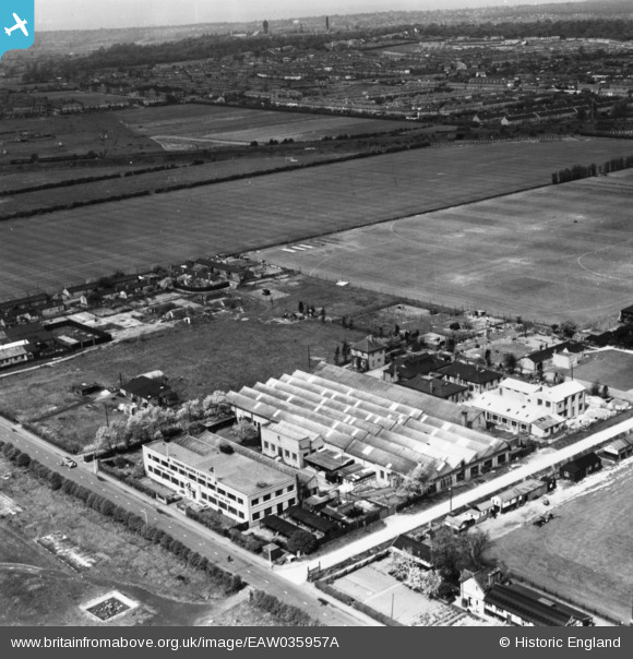
EAW035957A ENGLAND (1951). The Lehmann, Archer & Lane Ltd Hampshire Engineering Works, Fairlop, from the east, 1951. This image has been produced from a print.
© Copyright OpenStreetMap contributors and licensed by the OpenStreetMap Foundation. 2026. Cartography is licensed as CC BY-SA.
Nearby Images (10)
EAW035957A

EAW035951

EAW035953

EAW035954

EAW035948

EAW035952

EAW035949

EAW035950

EAW035955

EAW035947

Details
| Title | [EAW035957A] The Lehmann, Archer & Lane Ltd Hampshire Engineering Works, Fairlop, from the east, 1951. This image has been produced from a print. |
| Reference | EAW035957A |
| Date | 18-May-1951 |
| Link | |
| Place name | FAIRLOP |
| Parish | |
| District | |
| Country | ENGLAND |
| Easting / Northing | 545587, 190945 |
| Longitude / Latitude | 0.10223219674292, 51.598035430161 |
| National Grid Reference | TQ456909 |
Pins

Matt Aldred edob.mattaldred.com |
Sunday 8th of November 2020 10:18:52 PM | |
|
Matt Aldred edob.mattaldred.com |
Sunday 3rd of May 2020 04:25:19 PM |